0320L-WEDNESDAY OUTLOOK FROM /GARFIELD COUNTY EMERGENCY MANAGEMENT-3/17/21
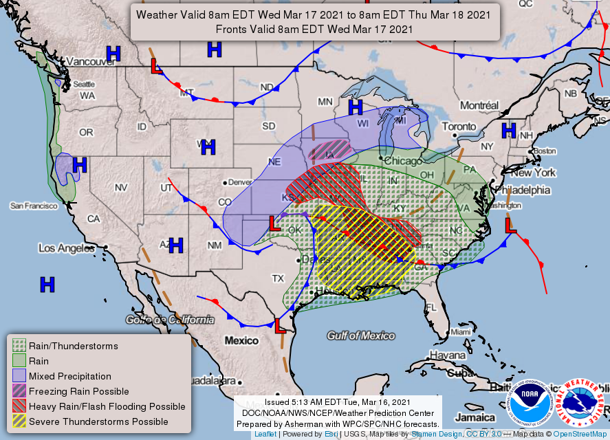
1- At 0245 it still raining and the NWS has a severe t-storm warning for the eastern one third and the SE half of the county. This will move out over the next few hours and then strong gusty northwesterly winds will be the issue for the rest of the day. There is a BLIZZARD WARNING in effect for parts of the Texas and Oklahoma panhandles and western Kansas. If you are heading that way, use EXTREME CAUTION. Also, Harper, Woodward, and Ellis counties could receive upwards of 2 to 4 inches of snow. Welcome to spring in Oklahoma!
2- We will be under a WIND ADVISORY today from 7am until 7pm for winds 25-35 mph gusting upwards to 50 mph. It should be an interesting day. I may take a nap! For the sake of fire safety, no controlled burning today please.
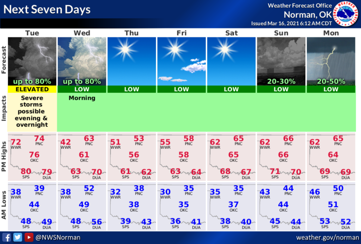
3- Overall, we may see some showers during the day but for the most part, nothing severe except cooler temps and gusty winds. We might even see some SNOW during the overnight hours from 0100 to 0500 local time as this low pressure system exits the area. Here is your countywide forecast from the NWS/NORMAN;
Today-Cloudy. A chance of rain showers early in the morning, then rain likely in the late morning and afternoon. Windy. Much cooler. Highs in the lower 50s. Northeast winds 15 to 20 mph shifting to the north 20 to 30 mph in the afternoon. Chance of precipitation 70 percent.
Tonight-Cloudy. A chance of rain in the evening, then a slight chance of rain and snow after midnight. Windy, colder. Lows in the mid-30s. Northwest winds 20 to 30 mph. Chance of precipitation 50 percent.
HAVE A GOOD DAY!
MIKE