0340L-TUESDAY OUTLOOK FROM GARFIELD COUNTY EMERGENCY MANAGEMENT-3/16/21
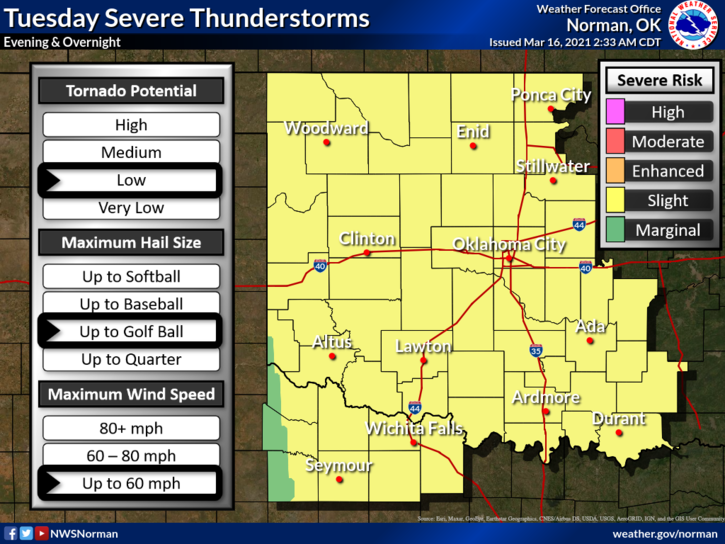
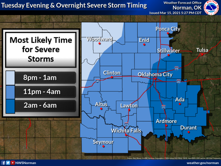
1- We are in a SLIGHT RISK for severe weather later tonight. Main threats appear to be large hail and damaging winds as I type this information. Depending on how storms form and track, we could face discreet supercell storms or a squall line known as a “QLCS” Quasi-Lineal Convective System. Tornado activity later tonight is a possibility and data will change throughout the day so we’ll update over the GARFIELD COUNTY EM app as needed. Be sure and get the app downloaded this morning.
2- Speaking of the app, this post appears every morning on the app under GCEM BLOG in the upper right quadrant. Just remember that NWS WARNINGS come through our app automatically. Preparedness for tonight is as follows: secure anything in your yard that could take flight due to winds, if you watch tv weather, don’t allow yourself to get hyper like they are as decision making under emotional distress can cause bad decisions to be made, just sayin.
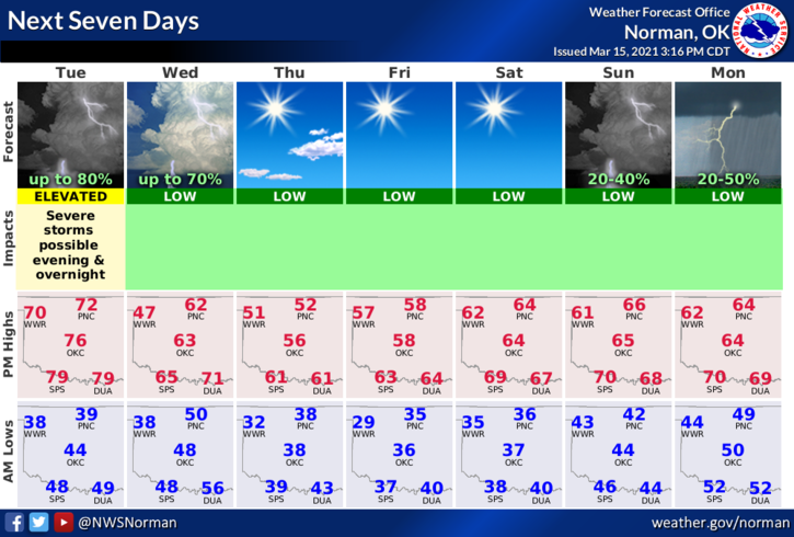
3- Overall, we should be ok but we may have some damage around the area if winds come through as forecast. We’ll see what happens. Here is your forecast from the NWS/NORMAN;
Today-Decreasing clouds. Warmer. Highs in the mid-70s. Southeast winds 10 to 15 mph.
Tonight-Partly cloudy. A chance of thunderstorms in the evening, then thunderstorms likely after midnight. Some thunderstorms may be severe. Lows in the mid 40s. Southeast winds 10 to 15 mph. Chance of thunderstorms 70 percent.
Have a good day and we’ll advise as needed.
MIKE