0410L-WEDNESDAY OUTLOOK FROM GARFIELD COUNTY EMERGENCY MANAGEMENT-3/24/21
1-CAUTION: There are several FLOOD ADVISORIES around the region. THE SALT FORK RIVER from Alva across to Tonkawa and the CIMARRON RIVER from Waynoka through Dover. There are no FLOOD WARNINGS yet but it’s not out of the question as we receive more rain. If you plan on traveling, stay extremely aware of river conditions along your route. Remember that your vehicle will float for a minute or so but then it sinks. Here is a saying to keep in mind; TURN AROUND, DON’T DROWN.
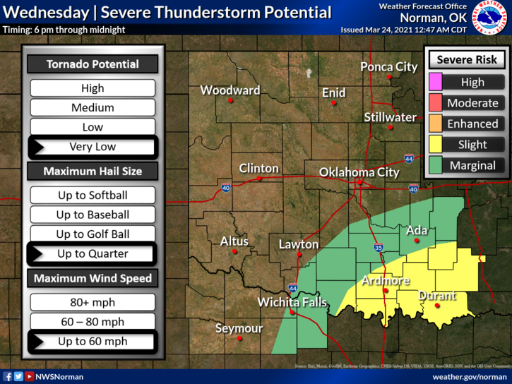
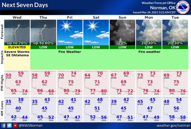
2- More rainfall is possible over the next few days so just stay aware of what’s going on and you should be ok. Severe weather is not expected in our area but remember it’s never out of the question. We’ll watch and advise. Here is your forecast from the NWS/NORMAN;
Today-Partly cloudy in the morning, then mostly cloudy with a slight chance of rain the rest of the day. Highs in the upper 50s. Northwest winds 10- 15 mph with higher gusts, shifting to the northeast in the afternoon. Chance of showers 30 percent.
Tonight-Mostly cloudy. A chance of thunderstorms in the evening and overnight. Lows in the lower 40s. North winds around 10 mph. Chance of thunderstorms 50 percent.
3- GARFIELD COUNTY EM is our notification app. If you don’t have it, you are NOT prepared.
HAVE A GOOD DAY!
MIKE