0330L-WEDNESDAY OUTLOOK FROM GARFIELD COUNTY EMERGENCY MANAGEMENT-9/8/21
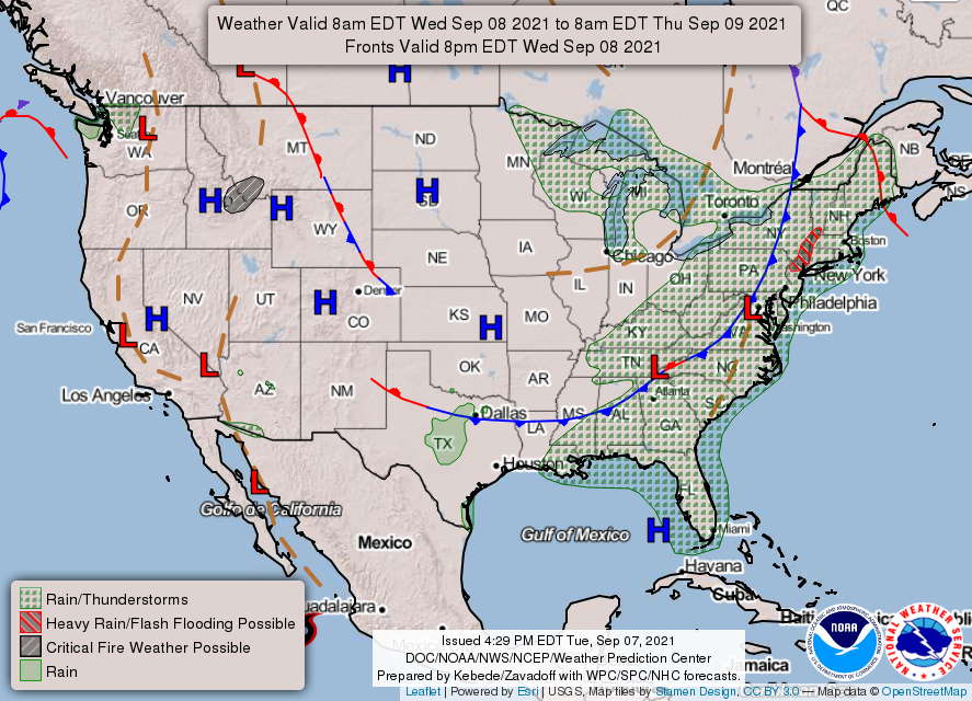
1- No more thunderstorm chances for a while. Some areas around the county received some rainfall but the heavier amounts were out west along with some wind damage due to 70-80 mph winds in Major County.
2- Our next issues will be the fire danger. We have had a wetter than normal summer and foliage is abundant but very stressed meaning it’s dry. Overgrowth all around the REGION is very apparent and this foliage catching on fire will become a major issue if YOU aren’t careful. I have stated for folks to be careful utilizing anything related to fire and I mean just that. It won’t take much to start a fire and it just could become a nightmare to get it put out depending on location. Use EXTREME CAUTION especially doing controlled burns.
3- Overall, we will be warming back up after today so stay hydrated and be careful out there.
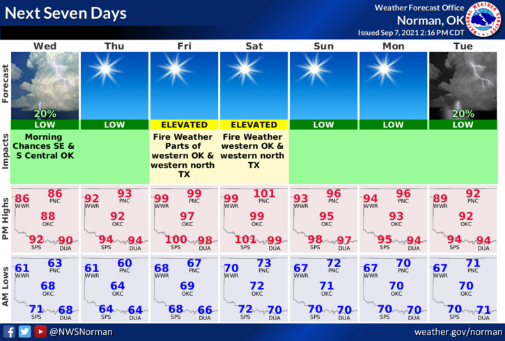
Here is your county-wide forecast from the NWS/NORMAN;
Today-Sunny. Not as warm. Highs in the upper 80s. Northeast winds around 10 mph.
Tonight-Mostly clear. Lows in the upper 50s. East winds around 10 mph in the evening becoming light and variable.
FINALLY: I don’t monitor social media all day long. Many folks send messages to me on messenger which I do NOT have on my phone. If you have questions concerning up and coming weather or whatever, email me. I don’t always see those messages sent to me until the next day on any social media platforms that I may monitor. I do see most email since it comes to my phone.
HAVE A GOOD DAY!
MIKE