0400L-FRIDAY OUTLOOK FROM ENID/GARFIELD COUNTY EMERGENCY MANAGEMENT-1/11/19
You better be prepared!! Download our GARFIELD COUNTY EM app. With the information that you get from our app, there’s no reason why you won’t be ready.
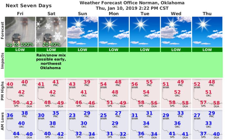
The Dodge City graph is new, the Norman graph is yesterdays. None were available from Wichita when I sent this post.
1-RAIN is our word for today. No severe weather is expected so if you happen to hear thunder, don’t panic!! Just enjoy the rain. We can possibly expect to receive “around” ½ inch of rain. The storm track isn’t set in stone so pay close attention to updates. We’ll see what happens as all this mess unfolds.
2-For those that get my Friday email; I am taking the day off. No email this week!!
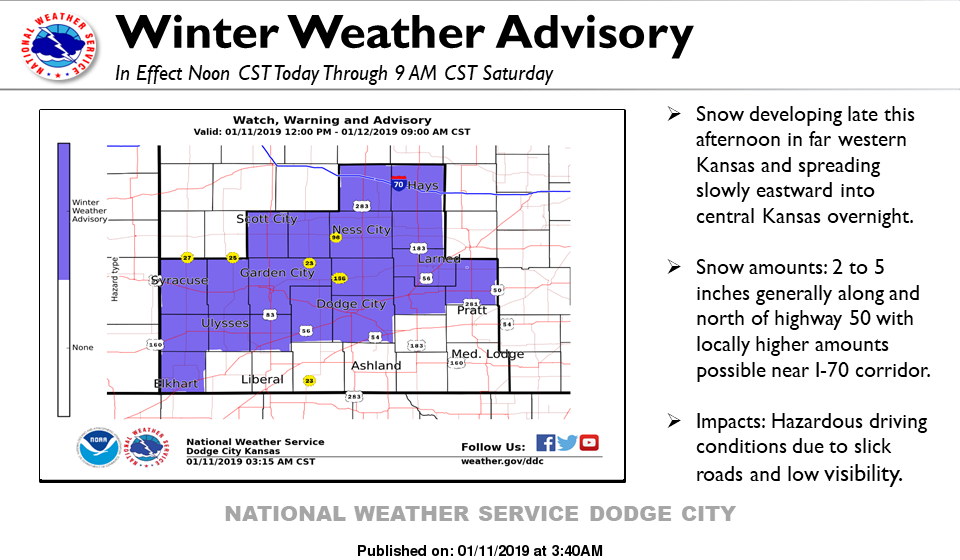
3- If you plan on traveling, going north could get you into some snow in western and central Kansas so make sure you check the forecast and road conditions at your destination BEFORE you leave.
4- Here is your forecast from the NWS/NORMAN;
Friday-Rain. High near 40. Southeast wind 10 to 15 mph. Chance of precipitation is 100%. New precipitation amounts between a half and three quarters of an inch possible.
Friday Night-Rain. Low around 35. East southeast wind 5 to 15 mph becoming north after midnight. Chance of precipitation is 80%. New precipitation amounts between a tenth and quarter of an inch possible.
HAVE A GOOD DAY!!
MIKE