0350L-THURSDAY OUTLOOK FROM ENID/GARFIELD COUNTY EMERGENCY MANAGEMENT-1/10/19
GARFIELD COUNTY EM- This is our notification app. It’s loaded with information and features that you just might need in an emergency. Why be mis-informed when you can be both prepared and informed? Download it today and learn how it works. You’re not prepared without it!
1- Mild again today but possibly cooler than yesterday. Rain will be possible later tonight through Saturday. Overall, not too bad. Keep a jacket or sweater handy as the wind will keep a chill in the air.
2- We are not under any drought conditions right now BUT continue to be careful utilizing anything related to fire as the foliage is very dry. Just be careful.
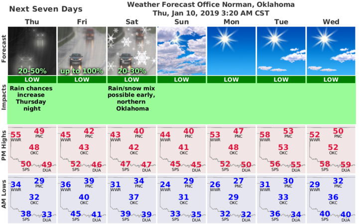
3- Here is your forecast from the NWS/NORMAN;
Thursday-Isolated sprinkles before noon. Partly sunny with a high near 50. South wind 10 to 20 mph gusting as high as 25 mph.
Thursday Night-30 percent chance of rain after midnight. Mostly cloudy, with a low around 40. South wind 10 to 15 mph, with gusts as high as 20 mph.
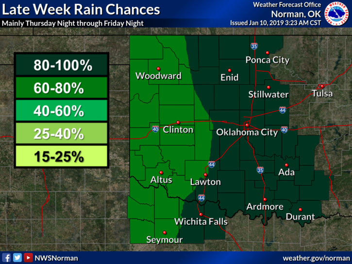
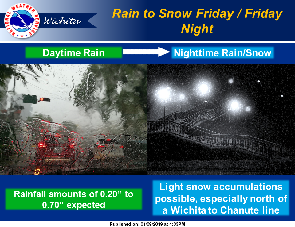
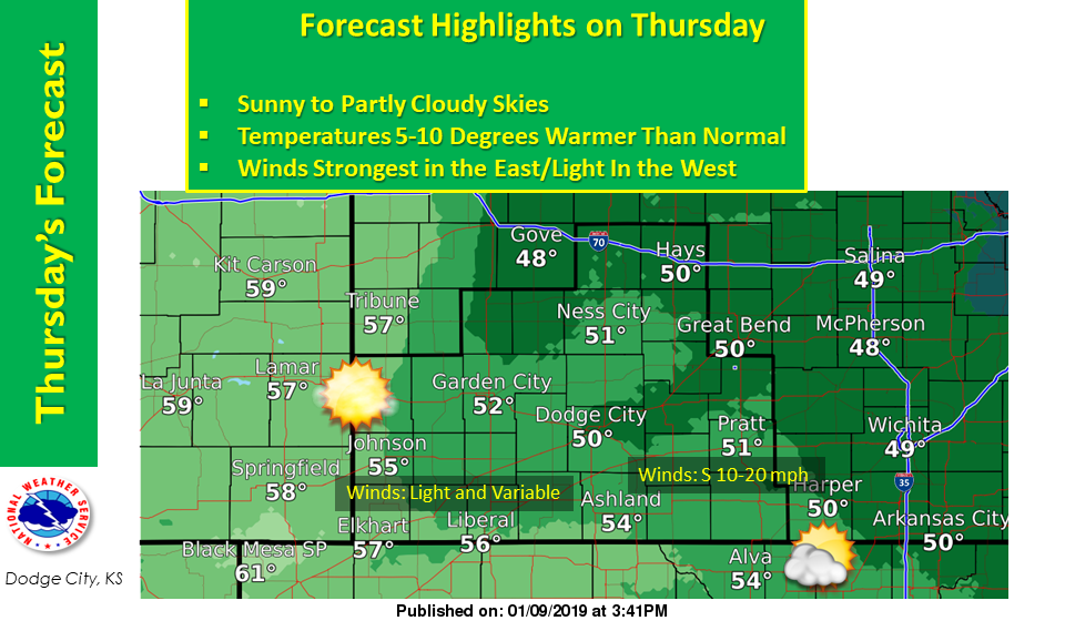
I have added a few extra graphs from Wichita and Dodge City NWS offices .
HAVE A GREAT DAY!!
MIKE