0340L-SUNDAY OUTLOOK FROM GARFIELD COUNTY EMERGENCY MANAGEMENT-1/24/21
GARFIELD COUNTY EM is our notification /emergency app. Download it today as it just might come in handy in the near future.
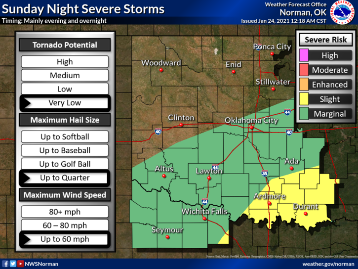
1- A cold front is expected this morning along with a chance for light rain. We aren’t expecting any severe weather but will not rule out thunderstorms. If thunderstorms do occur later today, they should be elevated in nature posing a possible hail threat. We’ll keep an eye out for this and advise accordingly. There are MARGINAL and SLIGHT RISK areas for severe weather south of I-44 so if you plan on traveling, stay weather aware in those areas.
2- That said, here is your forecast from the NWS/NORMAN;
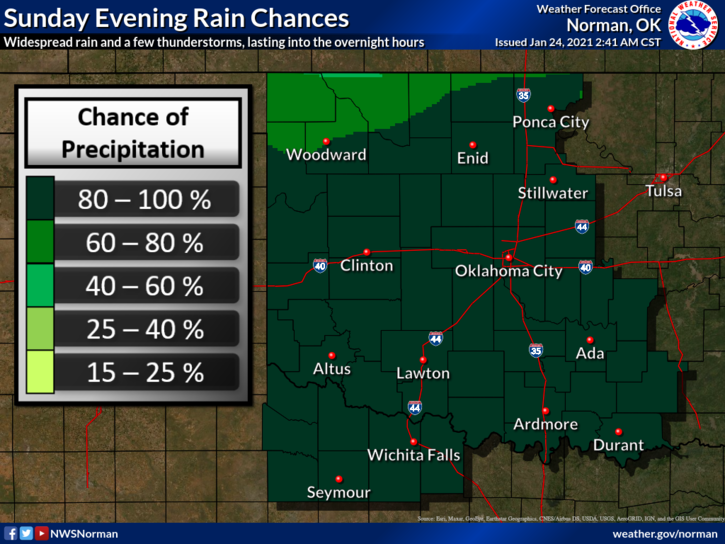
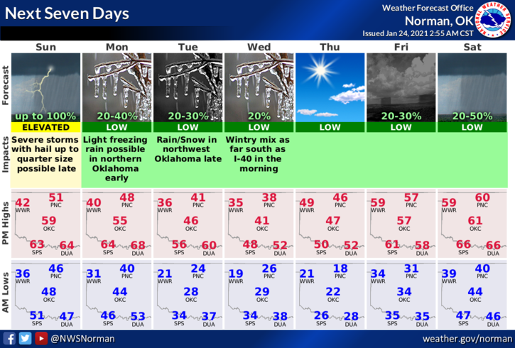
Today-Mostly cloudy. Areas of fog and drizzle in the morning, then a slight chance of rain showers in the afternoon. Highs in the lower 50s. Northwest winds around 10 mph shifting to the north in the afternoon. Chance of showers 20 percent.
Tonight-Rain showers and a chance of thunderstorms. Lows in the upper 30s. Northeast winds around 10 mph.
HAVE A GOOD DAY!!
MIKE