0415L-WEDNESDAY OUTLOOK FROM GARFIELD COUNTY EMERGENCY MANAGEMENT-5/26/21
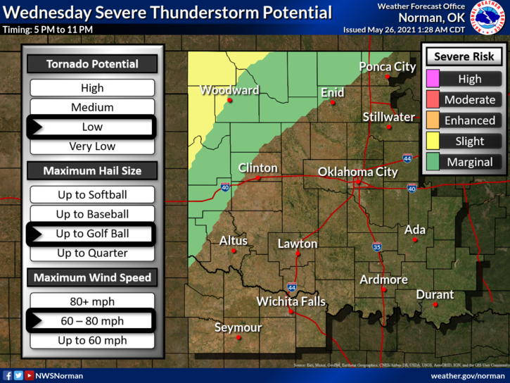
1- MARGINAL RISK for severe weather later tonight. If storms occur, hail and winds are the main threats. Today we will be mostly sunny and warm so enjoy that sunshine while its out.
2- Here is your forecast from the NWS/NORMAN;
Today-Partly cloudy. Highs in the upper 80s. Southeast winds 10 to 15 mph with higher gusts.
Tonight-Partly cloudy with a chance of thunderstorms. Lows in the upper 60s. South winds 10 to 15 mph with higher gusts. Chance of thunderstorms 30 percent.
IMPORTANT INFORMATION:
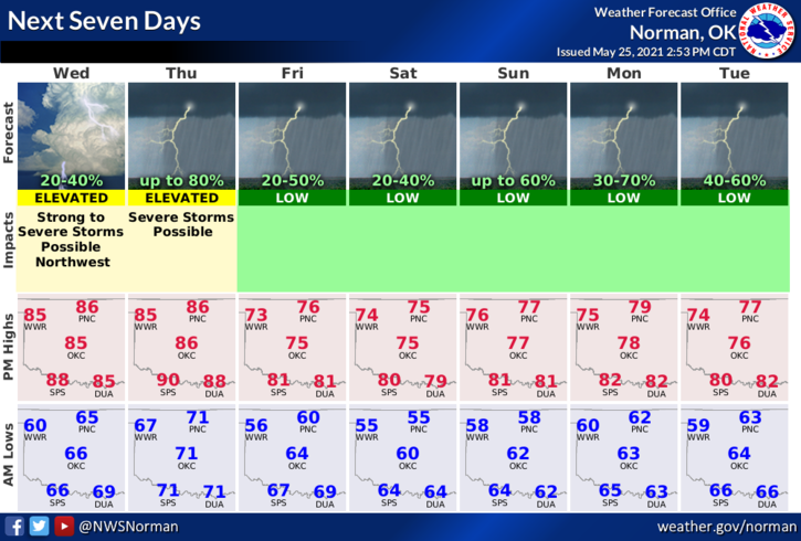
1-Thursday we will be in an ENHANCED RISK area for severe weather. It wouldn’t surprise me to see a higher risk added depending on what happens in northern Kansas later today. Due to a front setting up just to our north, a strong low level jet (strong winds aloft), and an extremely unstable humid atmosphere, we could see our first major severe weather event. HIGH WINDS and VERY LARGE HAIL look to be the main threats. Yes, there is a LOW tornado threat too.
All this said, make sure you have our GARFIELD COUNTY EM app and also at least 2 other ways to receive information. If you watch tv weather, prepare yourself for the extreme drama as it will be out of control. Maintain your emotions as we can’t stop what might occur but we can PREPARE for it. Most of all stay calm, understand what might happen, and prepare accordingly.
We’ll advise here and on our GARFIELD COUNTY EM app.
HAVE A GOOD DAY AND ENJOY THE SUNSHINE!
MIKE