0405L-THURSDAY OUTLOOK FROM GARFIELD COUNTY EMERGENCY MANAGEMENT-5/27/21
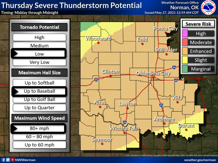
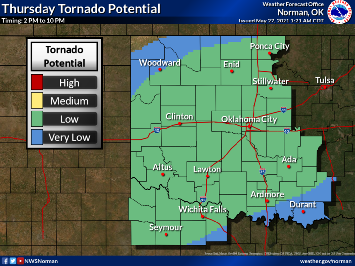
1- ENHANCED RISK FOR SEVERE WEATHER TODAY. Thunderstorms may form earlier than expected due to the front coming in a little faster than previous forecasts. It is expected to enter northwest Ok around mid-day. There are some mesoscale boundaries around the area left over by last nights storms and additional boundaries that are being created by the storms in southwest Ok at this hour. Storms that are ongoing in the Oklahoma Panhandle may be a party to putting out additional boundaries. Storms may likely form on these boundaries ahead of the main front. Read the information on the graphs that are attached to this post.
2- ALL THAT SAID, YES we have a good chance for severe weather. All weather hazards are possible. My main concern on all of this is the hail in the event supercell storms form over our area. The tornado threat is there BUT that probability is low. Don’t worry about any one feature but just be prepared for any and or all of these. I talk about preparedness all the time. Hopefully, most of you have planned accordingly.
3- Overall, we will be ok. We’ve been through these types of situations before so we’ll deal with this one too. As stated last night, all emergency services folks are on standby as we are every day, and the spotter side will be deployed if needed. Remember that making decisions in an emotional state can cause bad decision making. Be careful concerning all of the drama, you know where!!
4- Listen to our LOCAL radio stations when the event occurs and we’ll put out as much info as we can. Here is your forecast from the NWS/NORMAN;
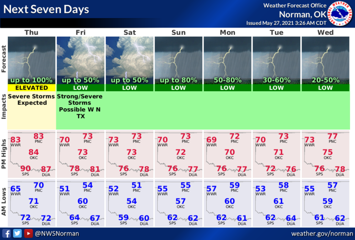
Today-A chance of thunderstorms in the morning, then thunderstorms likely early in the afternoon. Thunderstorms late in the afternoon. Highs in the mid-80s. Southwest winds 10 to 15 mph with higher gusts.
Tonight-Thunderstorms in the evening, then a slight chance of thunderstorms after midnight. Cooler. Lows in the mid-50s. North winds around 10 mph.
FINALLY, I will do a live update on social media on our emergency management page. That shortcut on facebook is @EGCEM
Have a good day!!
MIKE