0330L-MONDAY OUTLOOK FROM GARFIELD COUNTY EMERGENCY MANAGEMENT-2/21/22
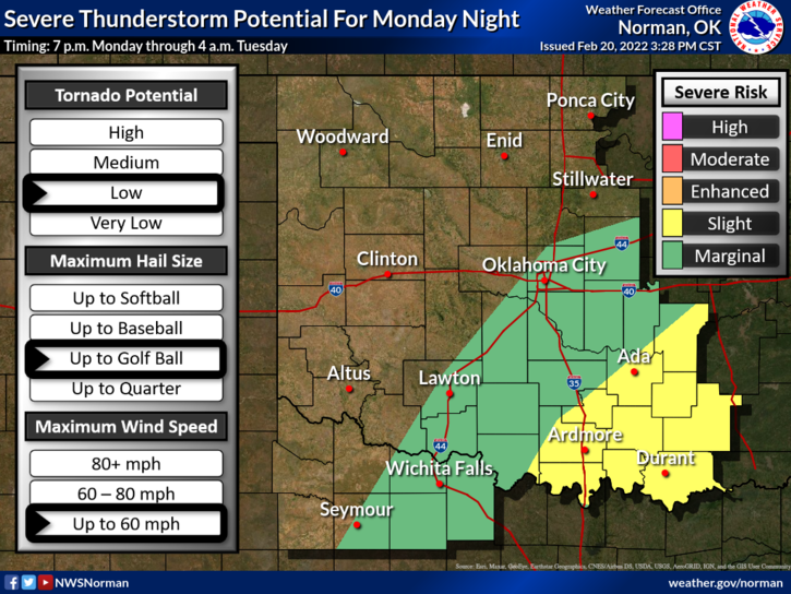
1-We are in a GENERAL THUNDERSTORM RISK area for later today even though it’s the far northern periphery. “If we see storms here”, it would most likely be just ahead or along the cold front that will push through the area later tonight. That threat for us appears to be low.
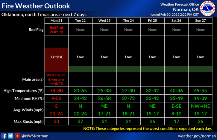
2- WINDS will be strong and average 21 mph with some gusts upwards of 35 mph. We are near a critical fire danger situation so no controlled burning today and be extremely careful if welding outdoors AND if you smoke, DO NOT throw your butts out the window. ONE SPARK is all it will take to ruin the day for many folks.
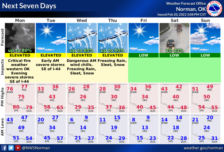
3- Per guidance, we may see some winter precip by Wednesday morning but as I have stated, the wind chill will be our biggest threat. You all should understand those parameters by now. Details for our area will change several times between now and then so just make sure you’re prepared for much colder weather.
4- Overall, we’ll be ok. Here is your forecast for WASHINGTON’S BIRTHDAY from the NWS/NORMAN;
Washington’s Birthday-Sunny and breezy. Highs in the mid-70s. South winds 15 to 25 mph.
Monday Night-Mostly cloudy. Much colder with lows in the mid-20s. South winds 15 to 20 mph, becoming west after midnight with gusts upwards to 35 mph.
HAVE A GOOD DAY!!