0325L-TUESDAY OUTLOOK FROM GARFIELD COUNTY EMERGENCY MANAGEMENT-2/22/22
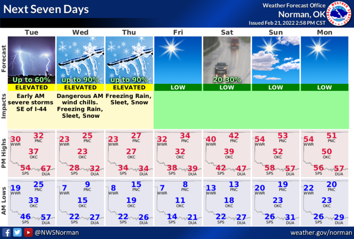
1- WIND CHILL ADVISORY in effect on Wednesday from 1am thru 10 am.
2- The cold is filtering in and the wind is blowing. Over the next several days expect the winds to average 20-25 mph and wind gusts should be around the 35 mph. There may be higher gusts so just keep that in mind.
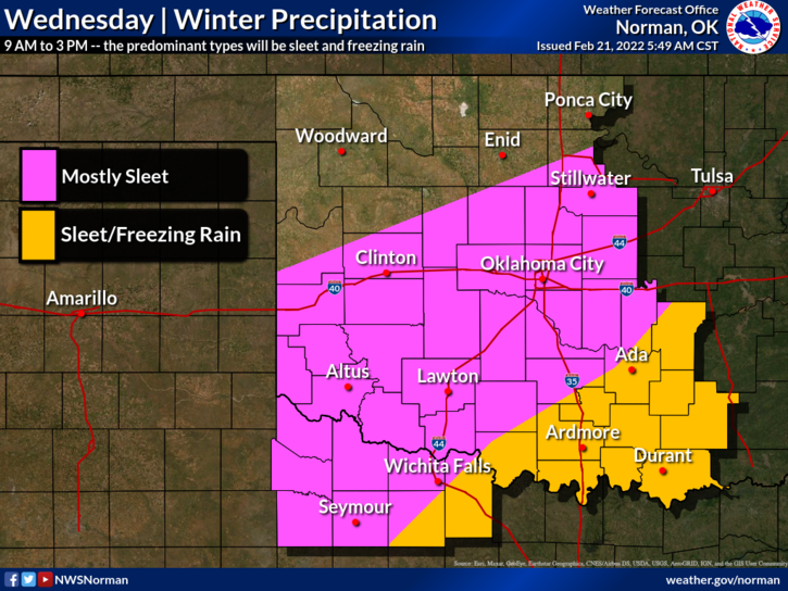
3- There is a low chance for some snow and sleet here starting Wednesday afternoon through Thursday morning. Our chances are 20% initially climbing to 40% Wednesday evening thru Thursday. Can’t say what accumulations may be so we’ll wait and see what happens.
4- Finally; As I have been stating for several days, the WIND CHILL will be the most dangerous thing we’ll deal with this time around. Yes, we might see some precip but the highest amounts of snow and ice will be in southern Oklahoma as it appears right now. Just stay weather aware and we’ll update as needed. The NWS will put out updates over our GARFIELD COUNTY EM app so if you have it, keep it close. Overall, we’ll be ok so here is your forecast from the NWS/NORMAN;
Tuesday-Sunny, with a high near 32. North northwest wind 18 to 23 mph, with gusts as high as 32 mph.
Tuesday Night-Mostly clear, with a low around 9. Wind chill values as low as -3. North wind 17 to 21 mph, with gusts as high as 31 mph.
STAY WARM AND SAFE.