0250L-THURSDAY OUTLOOK FROM GARFIELD COUNTY EMERGENCY MANAGEMENT- 11/6/25
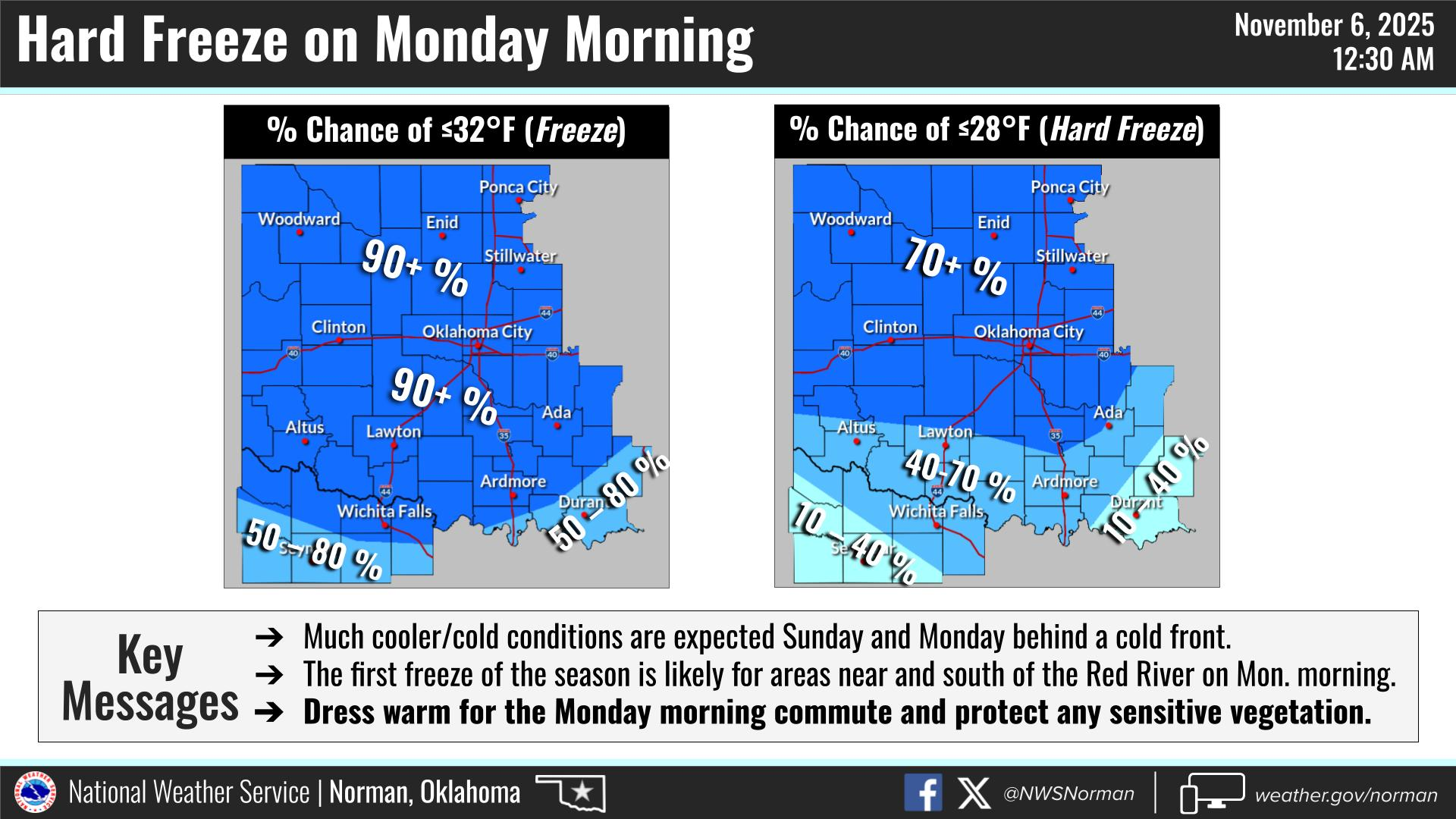
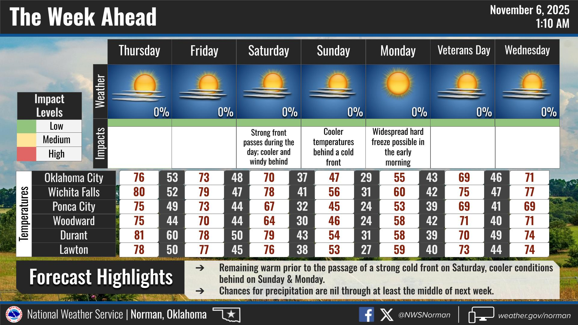
Some folks have been wondering when winter temps will arrive. After the front on Saturday comes through, you’ll start to feel those cooler temps. “Sunday” morning you should feel the effects of wind chill temps in the 20’s and high temps possibly not rising out of the low 40’s. We will deal with a few weaker fronts between now and Saturday. Monday morning “appears” that we’ll see a hard freeze with lows in the mid-20s or so.
All this said, I am serious about getting prepared for colder weather. The next week or so we’ll see temps dip into the low to mid 20’s for actual overnight temperatures and by mid-week, we’ll see highs come back into the 60’s or so. The winds will make it feel brutal at times so find your jackets and coats, shake them out, and prepare to wear them at least for a while. I will keep the link to our preparedness guide below here on my posts.
https://gcem.org/wp-content/uploads/2019/05/FamilyPreparednessGuide2019.pdf
NOTE: The fire danger will be slowly increasing as we move forward with no precipitation so use extreme caution if working with anything related to fire. The hard freeze will force plants and grasses to become dormant so be careful. There is a lot of fuel out there!
Overall, we’ll be ok, so here is your forecast from the NWS/NORMAN:
Thursday- Sunny. Highs in the mid-70s. Southeast winds 5 to 10 mph, becoming south 10 to 15 mph in the afternoon.
Thursday Night- Partly cloudy. Lows in the upper 40s. South winds 5 to 10 mph, becoming northwest after midnight.
GARFIELD COUNTY EM is our notification and preparedness app. If you don’t have it, you’re NOT prepared! REMEMBER that each day’s post appears under the GCEM Blog icon on the app.
HAVE A GOOD DAY!