0300L-WEDNESDAY OUTLOOK FROM GARFIELD COUNTY EMERGENCY MANAGEMENT- 11/19/25
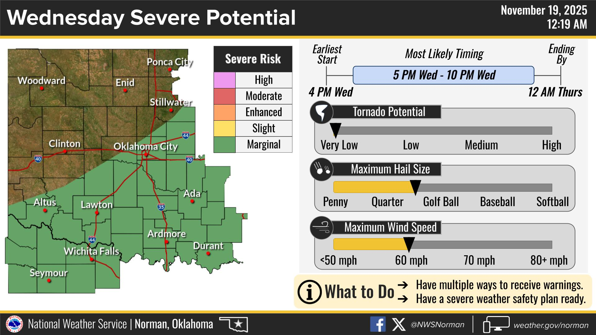
We are in a GENERAL RISK area for severe weather later today and overnight. A marginal Risk is south of us for today as it appears right now. Today’s threat would be in the event the cold front that passed through yesterday backs up as a warm front bringing very moist gulf air into the area. Not real sure that this will actually occur BUT we’ll have that chance overnight. Stronger low level flow aloft will be a factor as a storm system approaches from the west. If storms do occur, wind and hail should be our main threats. The tornado threat here is very low. We’ll have a chance for rain off and on through early next week. We’ll keep an eye out.
Overall, we’ll be ok, so here is your forecast from the NWS/NORMAN:
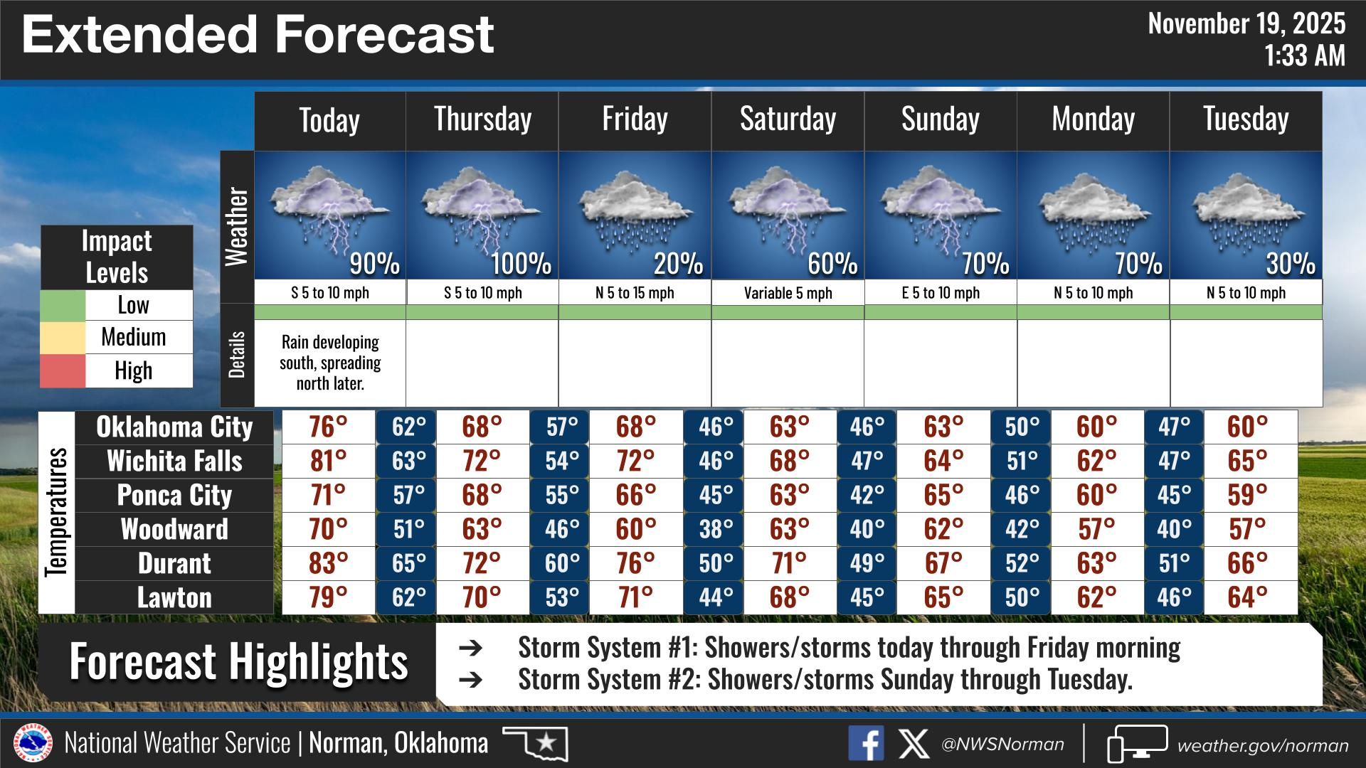
Wednesday- Mostly cloudy. Highs around 70. East winds 5 to 10 mph.
Wednesday Night- Mostly cloudy with a chance of showers. A chance of thunderstorms, mainly in the evening. Lows in the mid-50s. Southeast winds around 5 mph. Chance of rain 50 percent.
GARFIELD COUNTY EM is our notification and preparedness app. If you don’t have it, you’re NOT prepared! REMEMBER that each day’s post appears under the GCEM Blog icon on the app.
HAVE A GOOD DAY!