0250L-FRIDAY OUTLOOK FROM GARFIELD COUNTY EMERGENCY MANAGEMENT- 12/26/25
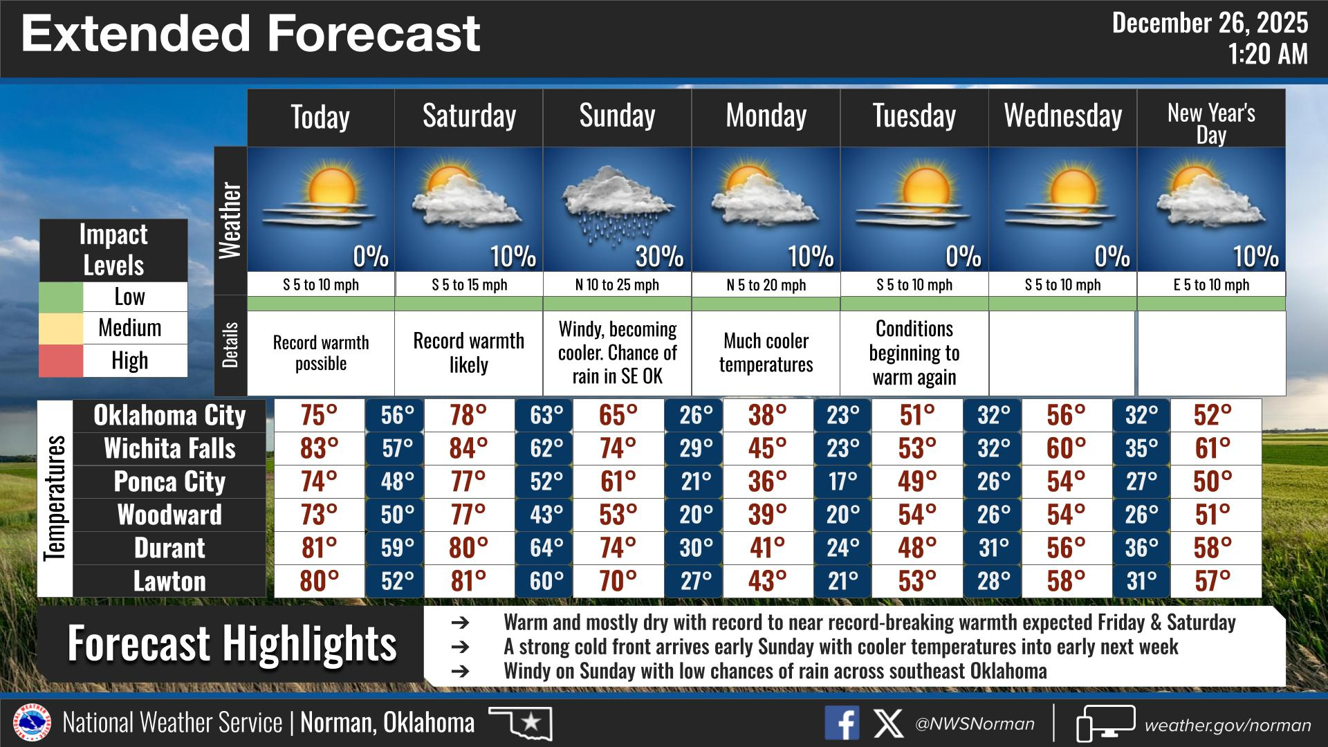
Hope everyone had a safe Christmas and enjoyed the day. We have a front that will move in this morning shifting the winds out of the north so we will most likely have highs in the low 70’s instead of in the low 80’s. The weekend looks good until a strong cold front pushes in early on Sunday, then it’s downhill from there. Here’s the kicker you should prepare for; MONDAYS high will be in the 30’s and the Monday morning low could be in the upper teens to low 20’s. Overnight lows next week will be in the 20’s and high temps look to average in the 50’s.
I will post a LIVE VIDEO on Monday with my intentions for renaming my EGCEM page and what I will do for weather this Spring. Not going totally away yet folks.
Overall, we’ll be ok so here’s your forecast from the NWS/NORMAN:
Friday- Sunny. Highs in the lower 70s. Northwest winds 5 to 10 mph, becoming east in the afternoon.
Friday Night- Mostly clear in the evening, then becoming partly cloudy. Lows in the upper 40s. South winds 5 to 10 mph.
GARFIELD COUNTY EM is our notification and preparedness app. If you don’t have it, you’re NOT prepared! REMEMBER that each day’s post appears under the GCEM Blog icon on the app.
HAVE A GREAT DAY!