FRIDAY WEATHER OUTLOOK FROM GARFIELD COUNTY EMERGENCY MANAGEMENT – 4/10/26
Good morning,
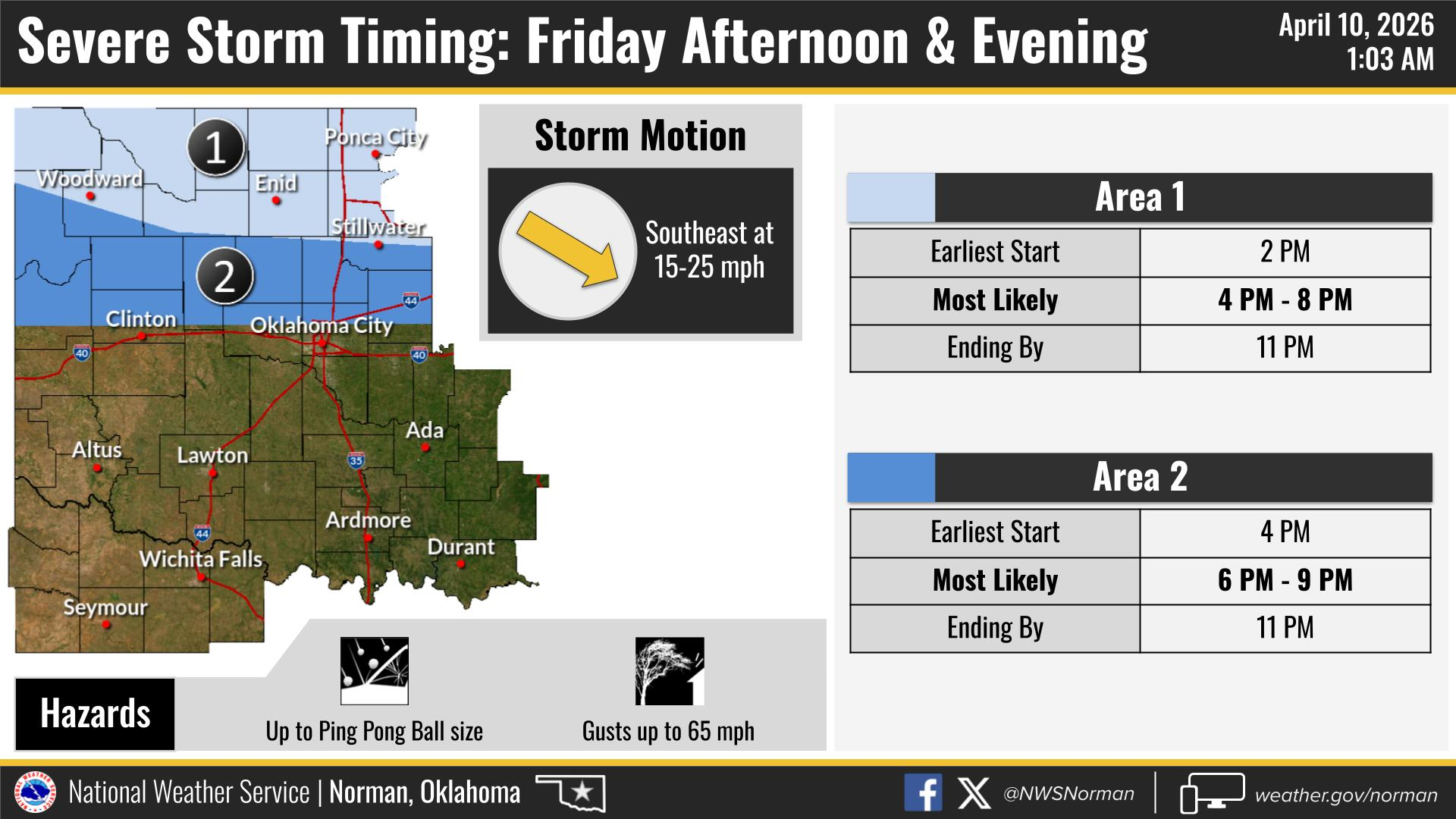
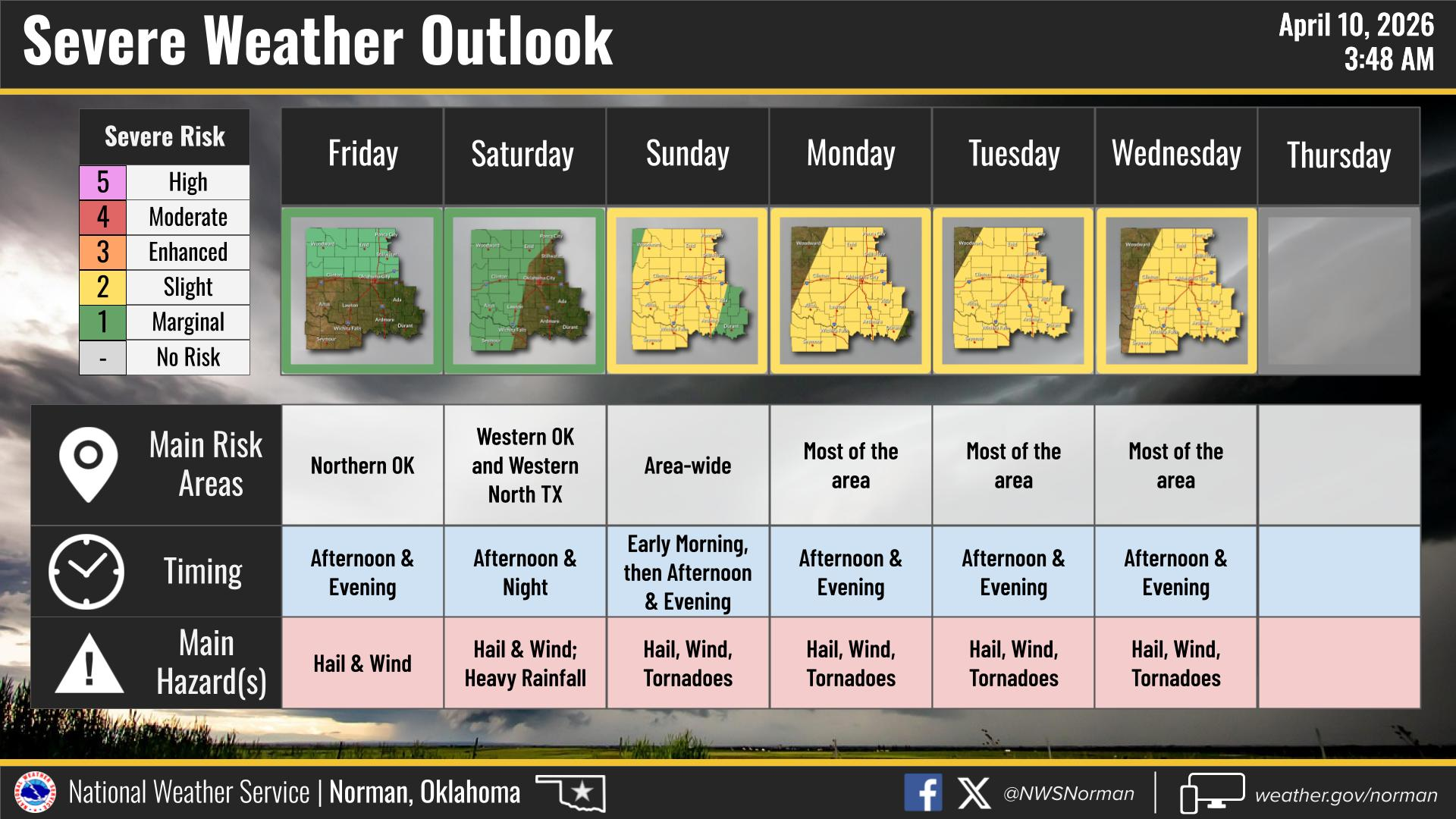
We’re still looking at a marginal risk for severe weather this afternoon into the evening. The main threats will be quarter to ping-pong ball size hail and winds around 60–70 mph.
Timing for our area: Most likely between 4:00 PM – 8:00 PM
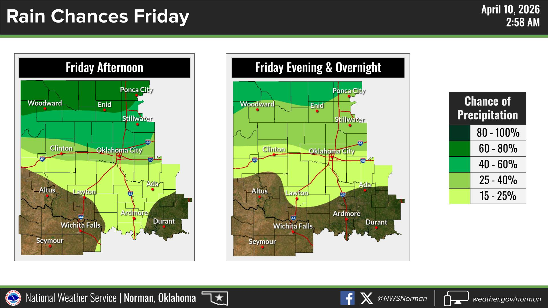
We’re also expecting about a 70% chance of rain across the area this afternoon, so plan for some wet conditions as storms develop.
The tornado threat is not zero, but it remains very low both today and into tomorrow. As always, we’ll be keeping a close eye on things and will pass along any updates if needed.
Detailed Forecast from NWS/Norman:
Today:
Partly sunny with a chance of showers and thunderstorms this morning, becoming more likely this afternoon. Highs in the upper 70s. South winds 10–15 mph. Rain chances around 70%.
Tonight:
Mostly cloudy with a chance of showers and thunderstorms, mainly during the evening. Lows in the upper 50s. Southeast winds around 10 mph. Rain chances around 50%.
Stay weather aware, especially later today, and have a great Friday!
Jacob Price, EM-1
Garfield County Emergency Management