Monday Weather Outlook from Garfield County Emergency Management – 8/31/2026
Another hot and dry day is ahead. ☀️
Today:
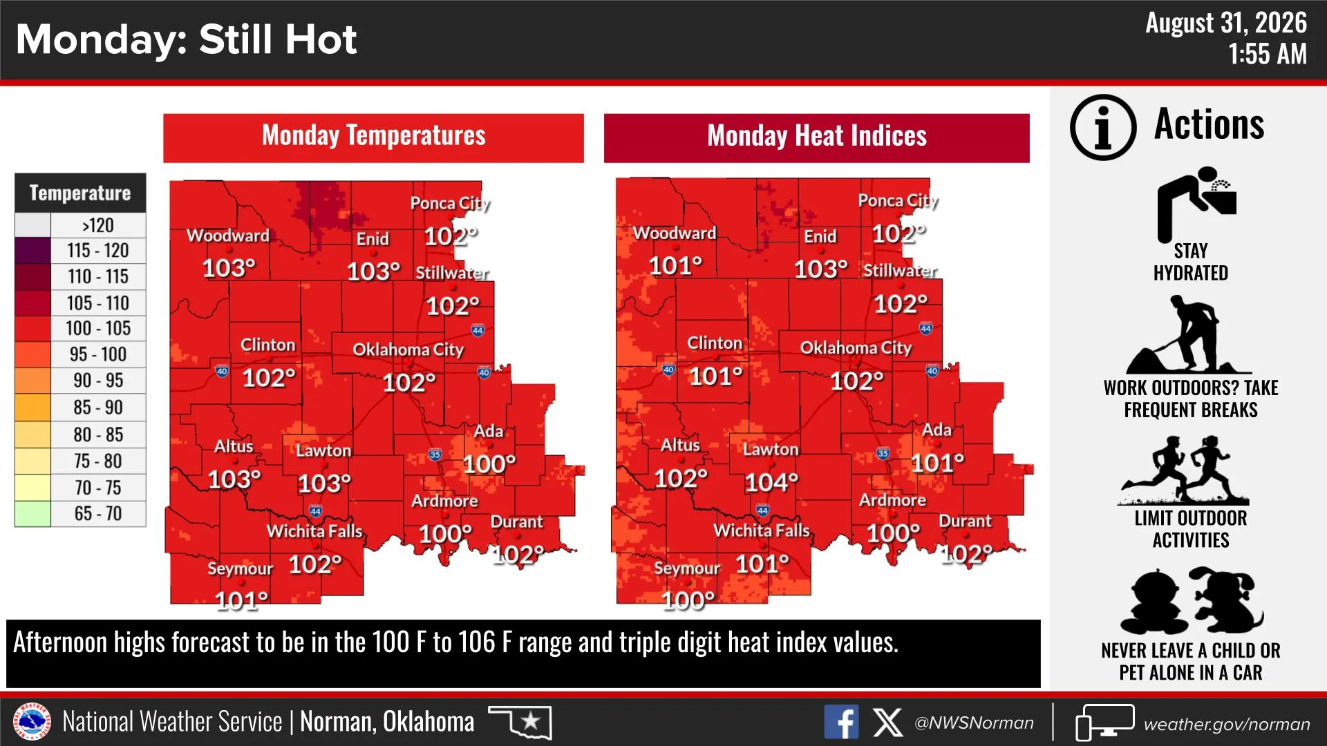
Sunny and hot, with highs around 102–103°F. South winds will be 10–15 mph, with gusts up to around 25 mph.
The heat will be the main concern today, with triple-digit heat index values possible. Across the Garfield County area, temperatures will be around 102–103°F, with heat index values also reaching the triple digits.
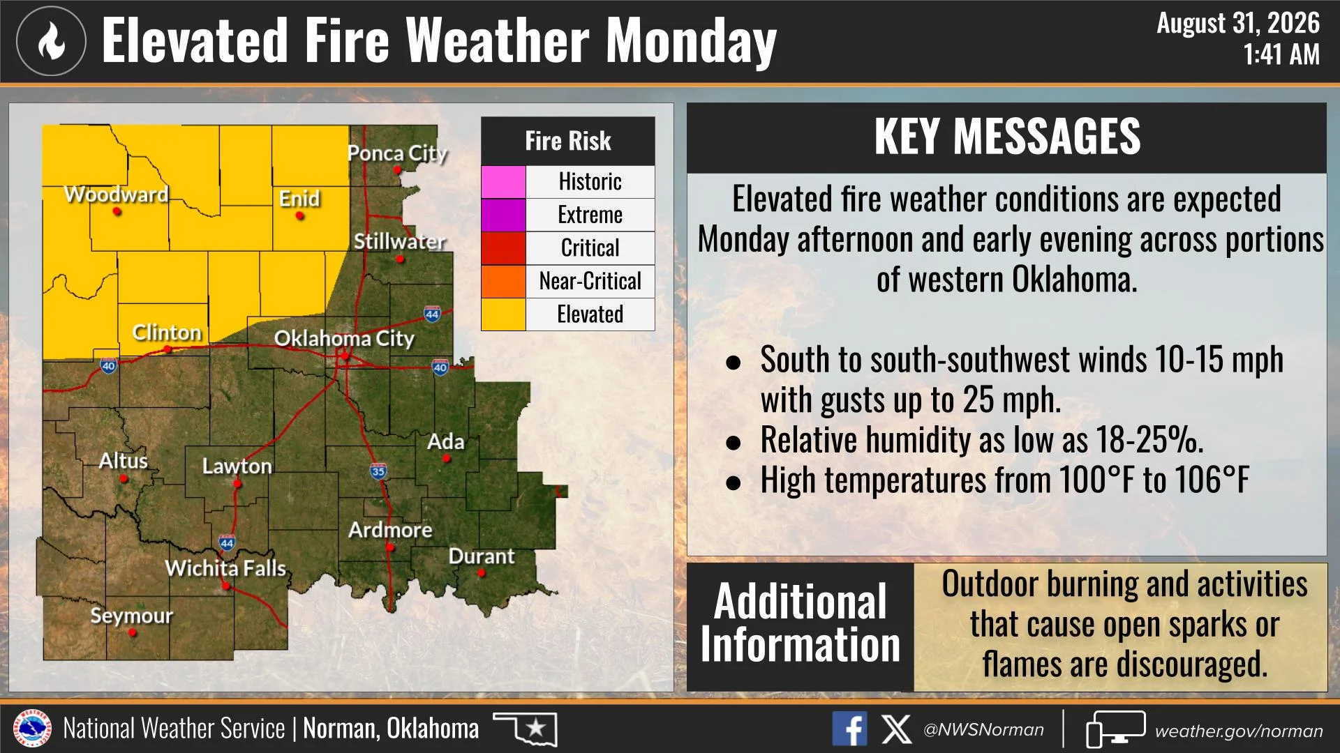
🔥 Elevated fire weather conditions are also expected this afternoon and early evening. Very dry vegetation, hot temperatures, low humidity, and breezy south winds will create an increased potential for fires to start and spread quickly.
For the Garfield County area, afternoon humidity could fall into the 20% range while south winds increase through the afternoon. Outdoor burning and activities that create sparks or open flames are discouraged.
💧 If you’re working or spending time outside today, stay hydrated, take frequent breaks, and limit strenuous outdoor activity during the hottest part of the afternoon. NEVER leave children or pets unattended in a vehicle.
Tonight:
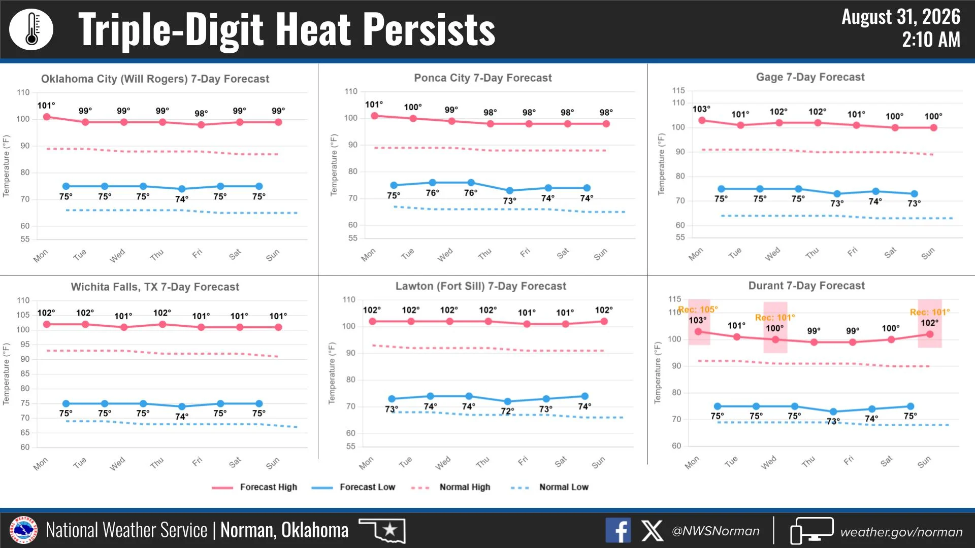
Clear and warm, with lows in the mid 70s. South winds will remain around 10–15 mph.
Overall, expect another hot, dry day across the Garfield County area, with elevated fire danger and dangerous heat for anyone spending extended periods outdoors.
Have a great Monday and stay safe!
— Jacob Price
Garfield County Emergency Management