FROM GARFIELD COUNTY EMERGENCY MANAGEMENT
Good morning,
I have measured ¼ inch of ice here on the west side of town. The saving grace of this is the fact that we are at 31 degrees and the temperature will slowly rise and the NUMBER 1 thing is that there is virtually NO WIND. We have been pretty lucky all weekend and I am ok with that.
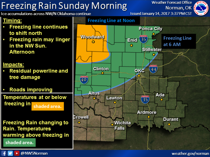
THE ICE STORM WARNING IS CANCELLED—WE ARE UNDER A FREEZING RAIN ADVISORY UNTIL NOON. This may be cancelled sometime this morning depending on conditions. If you have to get out early, drive slow and as we transition to warmer temps, the ice will melt!!
If by chance you are clairvoyant, and it seems that there are several out there that may be, give me a call and I can probably get you an interview for a job. A little sarcasm there concerning a few private messages received during this event.
Overall we faired ok with this weather. I want to Thank OGE for pre-staging folks all around the state so they could jump on outages quickly. This is expensive but necessary to keep power going. We learned a lot from past events. I want to thank all the others that do their respective jobs to protect and serve our citizens. Everyone did great. I want to thank you the citizens for using your common sense during this event. I don’t think there were very many major issues out there.
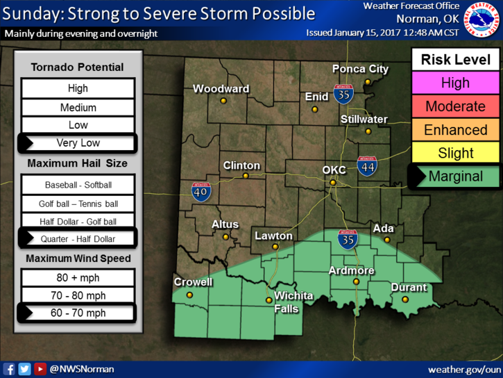
This evening we may see a thunderstorm or two but we need the rain. Severe storms in our area are not expected at this writing so we’ll watch and advise.
Here is your forecast from the NWS/NORMAN;
Sunday-A chance of rain or freezing rain before noon, then rain showers. Some thunder is also possible. Areas of fog before noon. High near 38. Northeast wind around 7 mph. Chance of precipitation is 80%. Little or no ice accumulation expected.
Sunday Night-Showers and possibly a thunderstorm. Low around 37. Northeast wind 7 to 11 mph becoming south after midnight. Chance of precipitation is 100%. New rainfall amounts between three quarters and one inch possible.
HAVE A SUPER DAY!!
MIKE