FROM GARFIELD COUNTY EMERGENCY MANAGEMENT
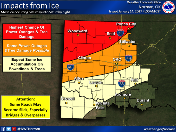
THE ICE STORM WARNING ISSUED BY THE NWS REMAINS IN EFFECT UNTIL SUNDAY MORNING AT 6 AM. AT 0245 WE HAD ACCUMULATED APPROXIMATELY 1/8 OF AN INCH OF ICE HERE IN THE COUNTY. This amount will vary so keep that in mind. It appears we may see more ACCUMULATION OF ICE AS FREEZING RAIN WILL CONTINUE “OFF AND ON” DURING THE DAY. One advantage we have right now is LIGHT WINDS. If you don’t have to be out, STAY AT HOME. Roads have become very hazardous.
THERE HAS ALREADY BEEN A ROLLOVER ACCIDENT NEAR WAUKOMIS THIS MORNING AND THERE WILL BE MORE. I CAN’T STRESS THIS ENOUGH, THE ROADS MAY NOT LOOK BAD BUT THERE IS ICE. BE EXTREMELY CAREFUL!!
Here is the forecast from the NWS/NORMAN;
Saturday-Freezing rain. High near 32. North northeast wind 6 to 8 mph. Chance of precipitation is 80%. New ice accumulation of 0.1 to 0.3 of an inch possible.
Saturday Night-Freezing rain. Low around 30. North northeast wind around 7 mph. Chance of precipitation is 80%. New ice accumulation of 0.1 to 0.2 of an inch possible.
Stay in, stay warm, and stay safe. HAVE A GREAT DAY!!
MIKE