0350L-THURSDAY UPDATE FROM ENID/GARFIELD COUNTY EMERGENCY MANAGEMENT-10/11/18
DOWNLOAD OUR “GARFIELD COUNTY EM” APP. You’re not prepared without it.
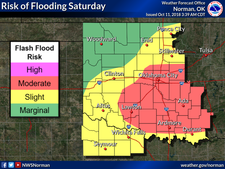
1- Flooding is occurring along some rivers and smaller tributaries in the region. While the water levels are receding, use extreme caution while traveling in those areas.
2- We will be dealing with 3 more fronts between now and Sunday evening. A winter mix is a slight possibility in the area on Monday morning. That said, periods of rain will occur all around the region beginning tonight, but it shouldn’t rain all of the time.
3- The path concerning the remnants of Sergio should be in the north Texas/southern Oklahoma area. This could change so just be aware. You can read the NWS DISCUSSION HERE- https://forecast.weather.gov/product.php?site=NWS&issuedby=OUN&product=AFD
4- Here is your forecast from the NWS/NORMAN;
Today-Partly cloudy. Highs in the upper 50s. Northeast winds around 10 mph.
Tonight-Mostly cloudy. A slight chance of rain and thunderstorms in the evening, then a chance of rain and a slight chance of thunderstorms after midnight. Lows in the upper 40s. Light and variable winds becoming southeast around 10 mph after midnight. Chance of precipitation 50 percent.
HAVE A SUPER DAY!
MIKE