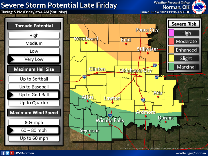
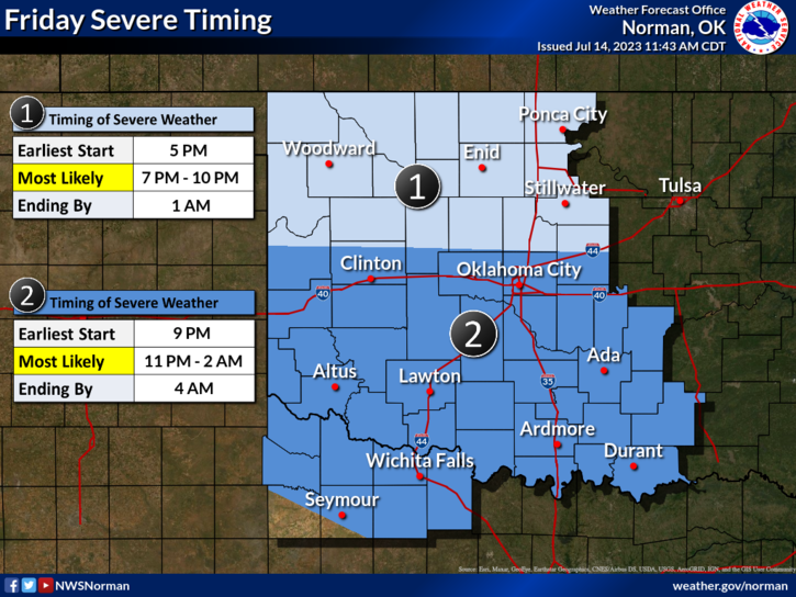
We are in an Enhanced risk for severe weather this evening. Starting time is actually hard to say but keep your eyes to the sky up north as we move into the early evening hours. Depending where supercell storms form will determine the severity of our weather. Under the supercells storms we could see golfball size hail and winds from 70-80 mph along with torrential rainfall. Rainfall totals here could be upwards of 1 to 3 inches depending on how fast these storms move. Right now the front isn’t moving very fast but should be in the area roughly in the 7 to 9pm timeframe. We’ll see what happens as this system gets its act together after while.
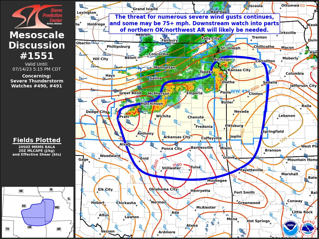
I am attaching a Mesoscale discussion to this post also so look at the graphics and read them carefully. The biggest threat we should have this evening will be the wind threat. Secure anything outdoor that could be launched by the winds and secure them.
Overall we should be ok so we’ll advise as needed.
Have a good evening.