0305L-FRIDAY OUTLOOK FROM GARFIELD COUNTY EMERGENCY MANAGEMENT-7/14/23
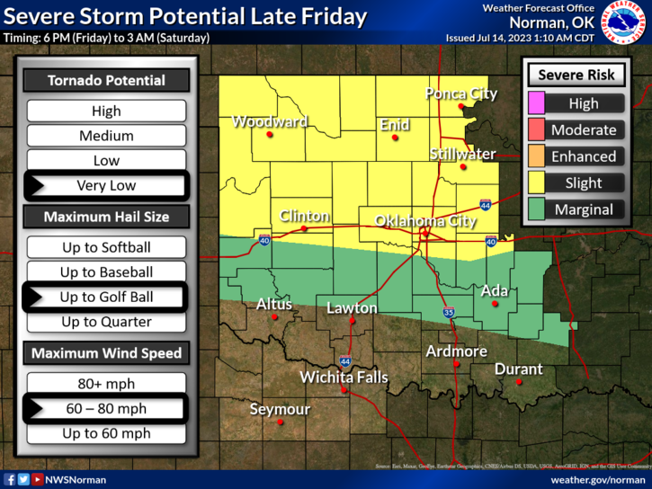
* SLIGHT RISK FOR SEVERE WEATHER THIS EVENING INTO THE OVERNIGHT HOURS. TIMING WILL BE SOMETIME BETWEEN 1800 (6PM) THIS EVENING TO 0300 (3AM) SATURDAY MORNING. Threats, IF storms occur, will be large hail to golf ball in size along with 60-80 mph maximum wind speeds. These parameters would occur in discrete supercell storms. We’ll see what happens.
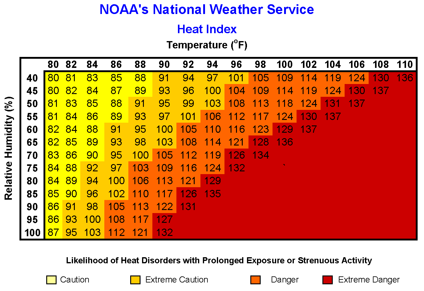
* HEAT-WISE: high temps today will reach the lower 90s with heat index values around 100. Continue to use caution while working outdoors and hydrate appropriately.
OVERALL, we’ll be ok so here is your forecast from the NWS/NORMAN;
Friday- Partly sunny. A chance of showers and thunderstorms, mainly in the morning. Humid with highs in the lower 90s. Southeast winds 5 to 10 mph. Chance of rain 50 percent.
Friday Night- Showers and thunderstorms likely, mainly in the evening. Humid with lows in the upper 60s. Southeast winds 5 to 10 mph, becoming northeast 10 to 15 mph after midnight. Chance of rain 60 percent.
*ADVISED & PREPARED? Download our GARFIELD COUNTY EM app and you will be.
HAVE A GOOD DAY!