FROM GARFIELD COUNTY EMERGENCY MANAGEMENT
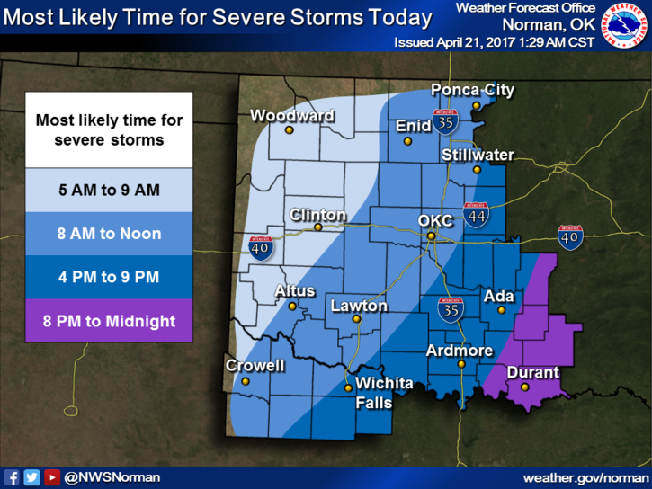
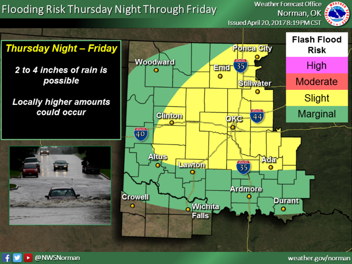
STORMY WEATHER is the term for today. We will most likely be in a SEVERE THUNDERSTORM WATCH AREA THIS MORNING SO KEEP THIS IN MIND AS YOU PLAN YOUR DAY. Hmm, preparedness in action!! As of 0400 this morning we had received around 3/4 of an inch of rainfall.
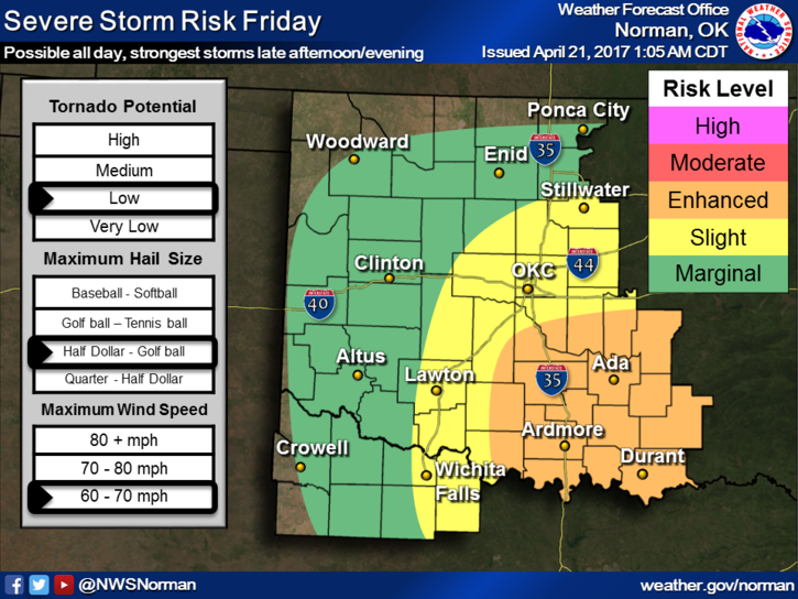
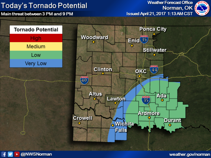
Without going into major detail, we will most likely deal with more scattered thunderstorms and a few may even be severe this morning. Storms may still be around this afternoon too. The threats for our area will be large hail and damaging winds. That said, if you plan on going south or southeast today, there is an enhanced risk and the tornado threat is higher there. Stay extremely aware of conditions when traveling in those directions today.
Overall, a wet day, so take an umbrella and try to stay dry. Now is a good time to get our GARFIELD COUNTY EM app and stay up to date with warnings and advisories.
Here is your forecast from the NWS/NORMAN:
Friday-Showers and thunderstorms. Some of the storms could be severe and produce heavy rainfall. High near 60. East northeast wind around 15 mph, with gusts as high as 21 mph. Chance of precipitation is 90%. New rainfall amounts between a half and three quarters of an inch possible.
Friday Night-50 percent chance of showers and thunderstorms before 1am. Cloudy, with a low around 44. North wind 16 to 21 mph, with gusts as high as 29 mph. New rainfall amounts of less than a tenth of an inch, except higher amounts possible in thunderstorms.
HAVE A SUPER DAY!!
MIKE