FROM GARFIELD COUNTY EMERGENCY MANAGEMENT
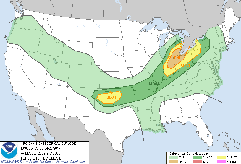
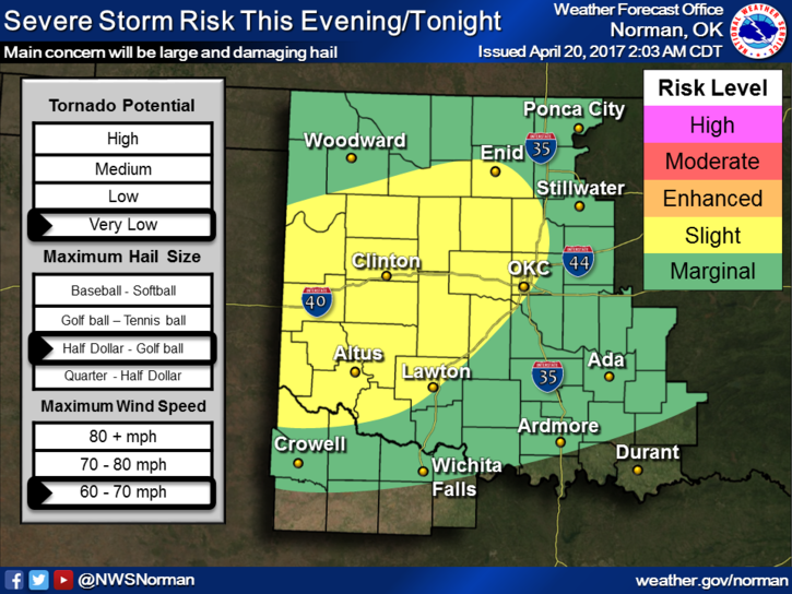
Garfield County is in a SLIGHT RISK area for severe weather later today and tonight. Hail and wind are the main threats. A cold front should move through the area this morning bringing in cooler air. Moist air will ride up over the top of this cooler airmass and then we’ll see what happens later this evening.
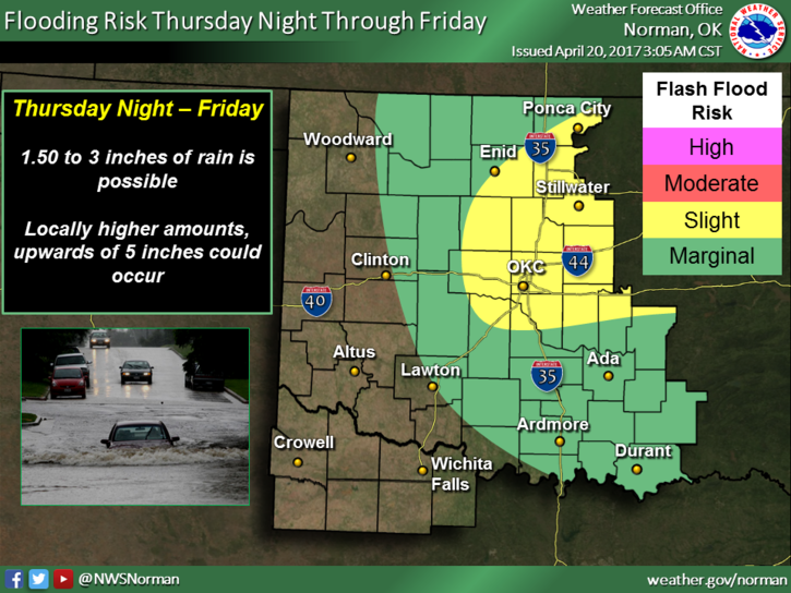
We are also in an Areal Flood Watch from late tonight through Friday evening for the POTENTIAL of flooding from rainfall based on the current forecast. Again, this may change a little so we’ll wait and see what the mid-day update looks like. There is no need to panic over anything right now or even later today. Mother Nature will do what she wants and we’ll deal with what happens. Remember that term I harp about all the time? It’s called PREPAREDNESS. I would consider looking into the definition and applying what you find out. It’s not difficult and will give you a little peace of mind.
Here is your forecast from the NWS/NORMAN;
Thursday-50 percent chance of showers and thunderstorms before 1pm. Partly sunny, with a high near 67. North northeast wind 13 to 15 mph, with gusts as high as 21 mph. New rainfall amounts of less than a tenth of an inch, except higher amounts possible in thunderstorms.
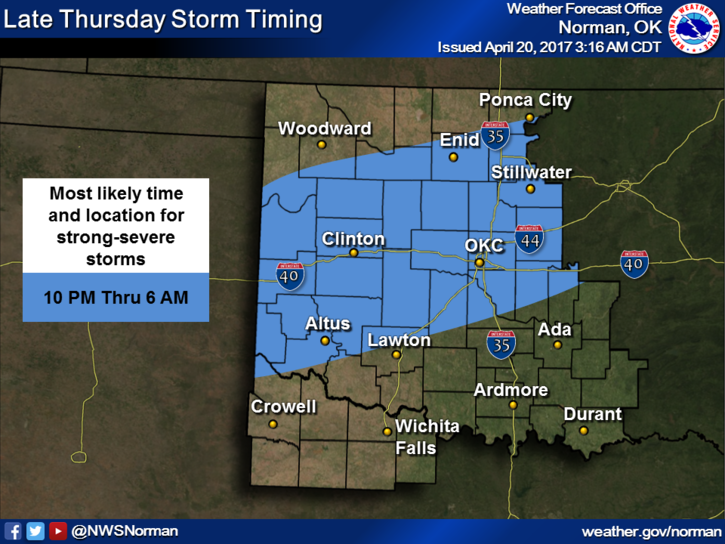
Thursday Night-Showers and thunderstorms likely, mainly after 1am. Mostly cloudy, with a low around 52. East northeast wind 7 to 11 mph. Chance of precipitation is 70%. New rainfall amounts between a half and three quarters of an inch possible.
HAVE A SUPER DAY!!
MIKE