0425L-FRIDAY UPDATE FROM ENID/GARFIELD COUNTY EMERGENCY MANAGEMENT-8/10/18
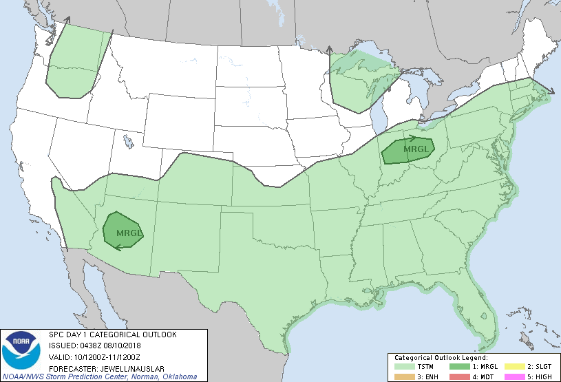
1- We are in a GENERAL RISK for thunderstorms today and over the weekend. Severe weather is not expected, per guidance, BUT we will have storms where the main threat will be winds. The atmosphere is unstable but wind shear isn’t abundant so most storms should be single cell in nature and possibly some multi-cellular storms where again; winds will be the main issue.
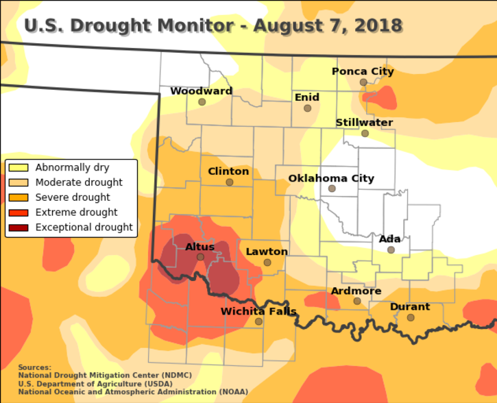
2-Drought-wise, we are still split between abnormally dry and moderate drought conditions. It just hasn’t rained around the whole county very much. Be careful utilizing anything that involves fire.
3-As stated above, there will be thunderstorms. If anyone has OUTDOOR games going on and you hear thunder, remember you can be hit by lightning. Shut the games down until storms completely clear the area. The mindset of getting the game in doesn’t justify an individual’s death. You may hear from me over the siren speakers. At that point, you won’t have a choice. Hopefully, that won’t be necessary.
4- Here is your forecast from the NWS/NORMAN;
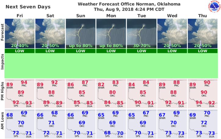
Today-Partly cloudy. Isolated thunderstorms in the afternoon. Highs in the mid 90s. Light and variable winds. Chance of thunderstorms 20 percent.
Tonight-Partly cloudy. Isolated thunderstorms in the evening. Lows around 70. Light and variable winds. Chance of thunderstorms 20 percent.
HAVE A GREAT DAY!!
MIKE