FROM GARFIELD COUNTY EMERGENCY MANAGEMENT-FRIDAY 8/11/17
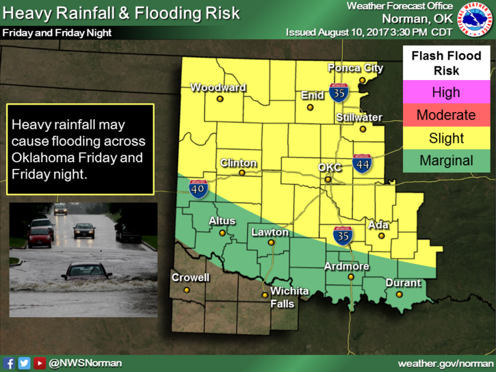
For those of you that really wanted rain, you have it!! I swear I didn’t do a rain dance. One thing about this is we are receiving a lot of rain thus making water channels dangerous throughout the county. Keep the kids out of those and watch out for our little snake, skunk, and other friends that live around those areas.
This pattern will persist with rain events in the late afternoon, evening, and overnight hours for the next 3-5 days. We are now in a FLOOD WATCH UNTIL SUNDAY MORNING. There are several flood warnings around the region so if you plan on traveling in any direction, check road conditions and remember if you come upon an area where a lot of water is over the road, TURN AROUND, DON’T DROWN!! By the way, DO NOT DRIVE AROUND BARRICADES.
DOWNLOAD OUR GARFIELD COUNTY EM APP if you haven’t done so yet.
Here is your forecast from the NWS/NORMAN;
Friday-Showers and thunderstorms, mainly before 10am. Some of the storms could produce heavy rainfall. High near 84. North northeast wind 6 to 8 mph. Chance of precipitation is 80%. New rainfall amounts between a tenth and quarter of an inch, except higher amounts possible in thunderstorms.
Friday Night-40 percent chance of showers and thunderstorms, mainly after 1am. Mostly cloudy, with a low around 69. East northeast wind 5 to 7 mph.
HAVE A SUPER DAY!!
MIKE