0400L-FRIDAY OUTLOOK FROM GARFIELD COUNTY EMERGENCY MANAGEMENT-8/19/22
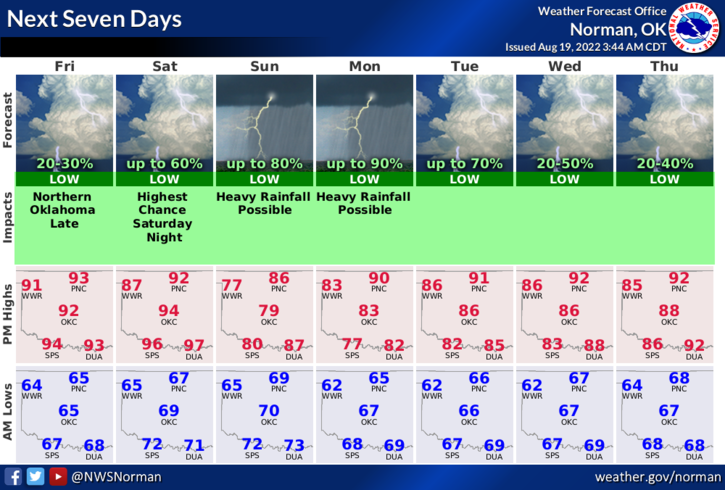
1- The low level thermal ridge that has plagued us all summer returns but with cooler temps. Instead of highs in the 100s, we’ll see highs in the low to mid-90s. Thunderstorms are expected in northern Kansas starting later this afternoon. We may see storms in our area later tonight from outflow boundaries pushing into our area.
2- Speaking of rainfall, Saturday through Monday we will cool down quite a bit with pretty good rainfall chances. The better chances will be south along the Red River. Hopefully, we’ll see some rain here.
3- Here is your forecast from the NWS/NORMAN;
Today-Mostly sunny. Highs in the lower 90s. South winds 5 to 10 mph.
Tonight-Partly cloudy with a slight chance of showers and thunderstorms. Lows in the upper 60s. Southeast winds 5 to 10 mph. Chance of rain 20 percent.
FINALLY, we are still in a severe drought so keep an eye peeled for smoke and fire and call 911 if you see anything. Also, keep an eye out for suspicious activity.
HAVE A GOOD DAY!