0430L-FRIDAY OUTLOOK FROM ENID/GARFIELD COUNTY EMERGENCY MANAGEMENT-12/7/18
WINTER STORM WATCH STILL IN EFFECT FROM 6am TODAY UNTIL SATURDAY EVENING as of right now. It wouldn’t surprise me to see this become just an advisory sometime today for our area.
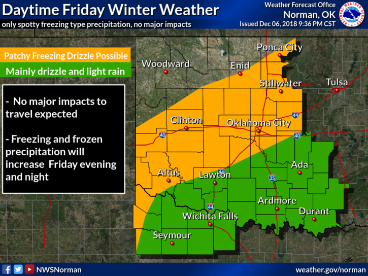
1- Winter impacts look a lot lower now than before since this storm system is tracking farther south. Then comes the question, will we still see snow? MAYBE. The actual track is still an issue but if we do see any snow, it would most likely be around an inch.
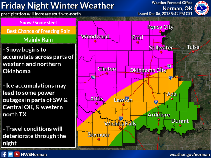
2-Take a deep breath.. There will be areas south of here that may see some snow and possibly some freezing rain. We’ll still have to wait and see what actually happens and as I have stated all week, THE FORECAST WILL CHANGE.
3- For us, go to work and to school and if you plan to travel, check the forecast wherever you plan to go. I am sure it will change.
4-Here is your forecast from the NWS/NORMAN;
Friday-Cloudy, with a high near 34. Northeast wind around 8 mph.
Friday Night-Slight chance of rain or freezing rain before midnight, then a slight chance of snow. Cloudy, with a low around 27. Northeast wind 7 to 13 mph. Chance of precipitation is 20%.
HAVE A LESS-STRESSFUL DAY
MIKE