0350L-FRIDAY UPDATE FROM GARFIELD COUNTY EMERGENCY MANAGEMENT-2/16/18
1- A few raindrops fell yesterday doing nothing for the drought but making me double check that that moisture wasn’t from birds flying around the area. That has happened to me in the past!!
2- After looking at several rain possibilities forecast-wise, don’t hold your breath for any length of time. Rain will come in time but hopefully before we start losing crops around here.
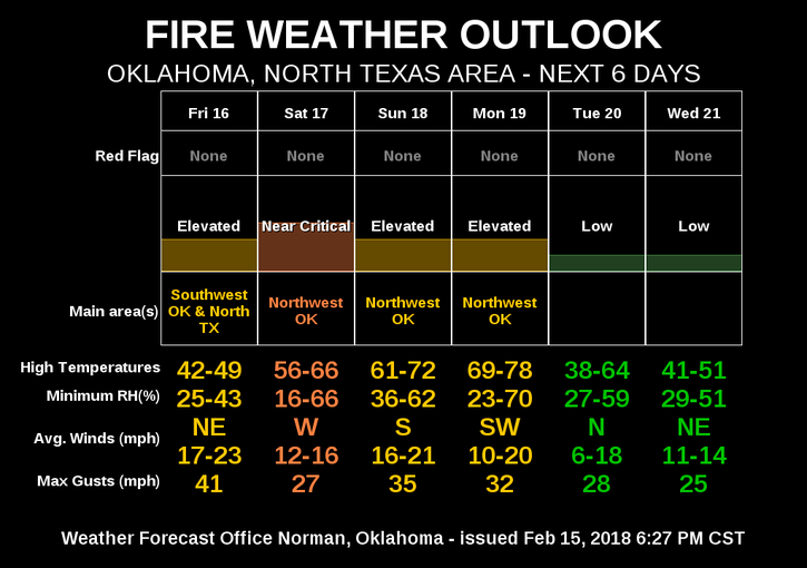
3- The BURN BAN HAS BEEN “EXTENDED” UNTIL MARCH 2ND AT MIDNIGHT. The FIRE DANGER is HIGH so please continue to be careful and report smoke and fire to 911 immediately. We in emergency services, THANK YOU.
4- We will be cooler today but we’ll warm up over the weekend so enjoy the warmth but carry an anchor with you due to the winds. Winds won’t really be that bad, just some humor at 0345L.
5- Here is your forecast from the NWS/NORMAN;
Friday-High near 42 with North winds 15 to 25 mph gusting to 30 becoming NE 5 to 15 mph this afternoon.
Friday Night- Low around 34 with East winds 5 to 15 mph becoming south after midnight.
HAVE A GREAT DAY, DON’T TEXT AND DRIVE, SLOW DOWN IN SCHOOL ZONES.
MIKE