0415L-THURSDAY UPDATE FROM GARFIELD COUNTY EMERGENCY MANAGEMENT-2/15/18
1- ENJOY today because temps will be about 40 degrees cooler tomorrow. Yes, we have a cold front that will push into the area later today. Today’s high will be “around” a windy 80 degrees.
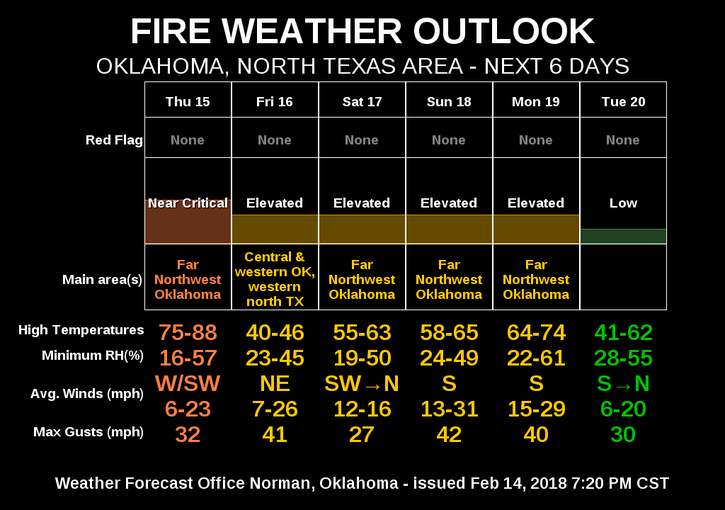
2- Elevated fire conditions are still ongoing so be very careful out there and report any fire to 911
3- The county is split between EXTREME and SEVERE drought conditions. The new monitor should be out today. New guidance should dictate whether the Governor extends the BURN BAN. Hopefully she does.
4- Here is today’s forecast from the NWS/NORMAN;
TODAY- High near 80. SSW winds 10 to 15 mph gusting to 25. Winds will become NNW later today
Tonight- Low around 27. Windy, with WNW winds 10 to 15 mph becoming north 20 to 25 mph in the evening. Winds gusts to 35 mph or higher are possible.
5- Rain chances APPEAR to be possible on Monday. We’ll hope it does.
HAVE A GREAT DAY!!
MIKE