0355L-FRIDAY OUTLOOK & INFO FROM GARFIELD COUNTY EMERGENCY MANAGEMENT-1/31/2020
1- GARFIELD COUNTY EM is our notification app. People talk preparedness but don’t have our app. You are NOT PREPARED in Garfield County without this app. PREPAREDNESS=RESILIENCE
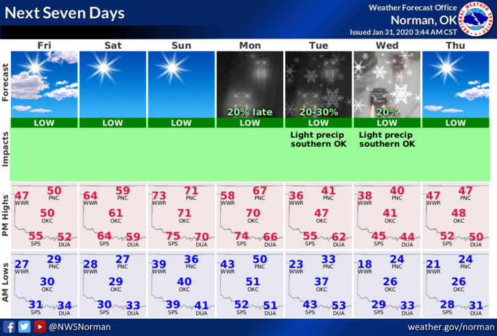
2- A cold front will push through the area this morning but won’t have a dramatic effect on the area except for winds. Our next chance for any precipitation will be in the Monday-Tuesday timeframe. It’s too early to say one way or the other what type of precip we may see. Moisture looks a little bleak right now.
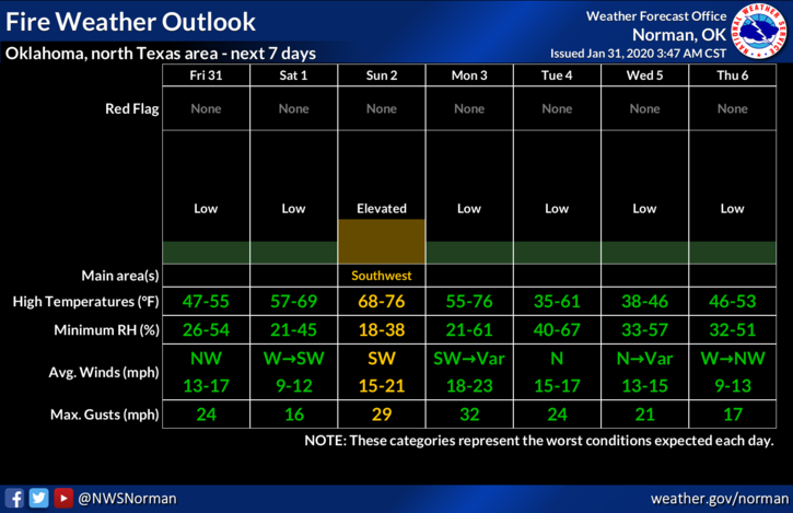
3- The weekend looks good so get outside and enjoy it. Keep one thing in mind, the FIRE DANGER WILL INCREASE SO PLEASE BE CAREFUL OUT THERE.
Here is your forecast from the NWS/NORMAN;
Friday-Mostly sunny with a high near 48. Northwest wind 10 to 15 mph gusting to 20 mph.
Friday Night-Mostly clear with a low around 28. West wind 5 to 10 mph.
HAVE A GOOD DAY!!
MIKE