FROM GARFIELD COUNTY EMERGENCY MANAGEMENT-FRIDAY JULY 28, 2017
It’s Friday and we’ll be able to enjoy cooler temps in the 90’s instead of the 100’s for the next several days. We may even have some high temps in the 80’s over the weekend into the first of next week. The only bad thing is the winds will be light so the cooling effect for many of us will not be there. Use extreme caution while working outdoors. ALSO, keep an eye on the kids and animals. We may be cooler but the heat index will still climb into the mid to upper 90’s.
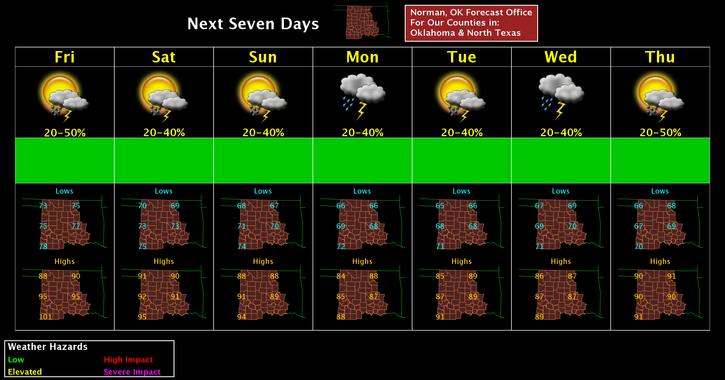
Here is your forecast from the NWS/NORMAN;
Friday-30 percent chance of showers and thunderstorms, mainly between 7am and 1pm. Mostly cloudy, with a high near 90. Heat index values as high as 99. Northeast wind around 9 mph.
Friday Night-Mostly cloudy, with a low around 70. East wind around 8 mph.
I hope the winter pic cools you off some. 🙂
HAVE A SUPER DAY!!
MIKE