FROM GARFIELD COUNTY EMERGENCY MANAGEMENT-THURSDAY JULY 27TH 2017
First of all, to be prepared here in GARFIELD COUNTY, download our GARFIELD COUNTY EM app. If you don’t have our app, you are not prepared. We will send out pertinent information as needed to keep you advised on weather or incident information.
At 0315 this morning, we have had a trace of rainfall and at 0400 we are fixing to get a little more. It won’t be too much but it does give us hope. The county is in a MARGINAL Risk area for possibly some severe weather this afternoon and evening. The main threat would most likely be wind. The best explanation on this is storms build really fast, move slowly-thus the heavy rainfall, and then they collapse-hence the strong winds. If we see the heavier storms, just be prepared for gusty winds later today. Overall, we’ll be ok.
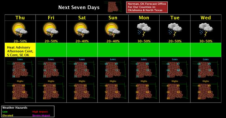
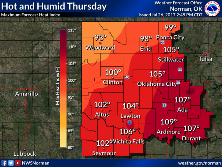
Temps will be lower today so enjoy this while you can as we will be heading into August and YES FOLKS, we will see temps at, near or above 100 several more times before fall. Here is your forecast from the NWS/NORMAN;
Thursday-30 percent chance of showers and thunderstorms, mainly after 1pm. Partly sunny, with a high near 92. Heat index values as high as 98. West southwest wind 7 to 11 mph becoming north in the afternoon.
Thursday Night-30 percent chance of showers and thunderstorms. Mostly cloudy, with a low around 73. North wind 6 to 9 mph.
HAVE A SUPER DAY!!
MIKE