0415L-FRIDAY OUTLOOK FROM GARFIELD COUNTY EMERGENCY MANAGEMENT-6/25/21
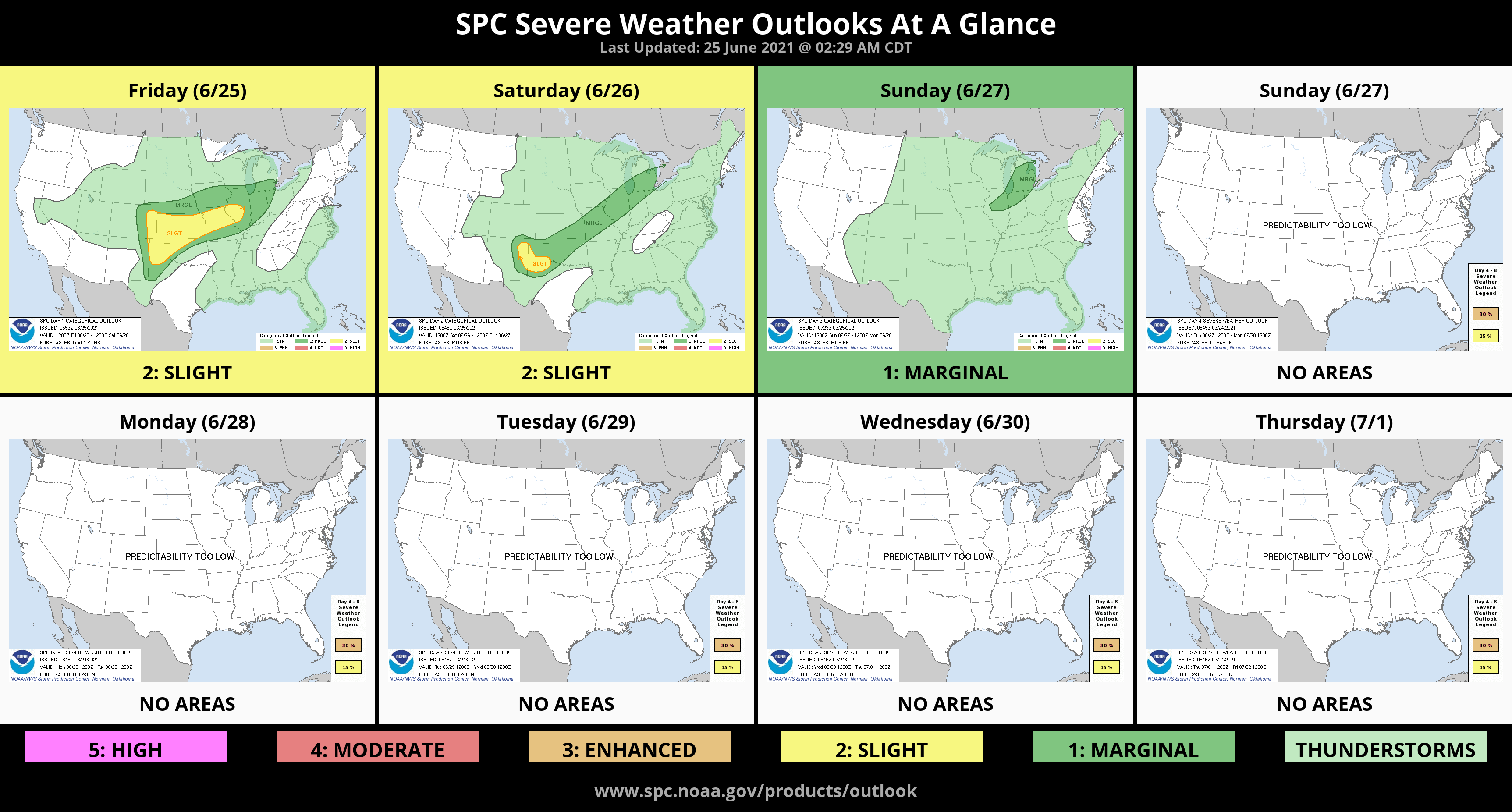
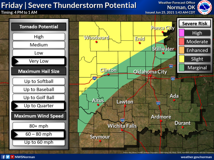
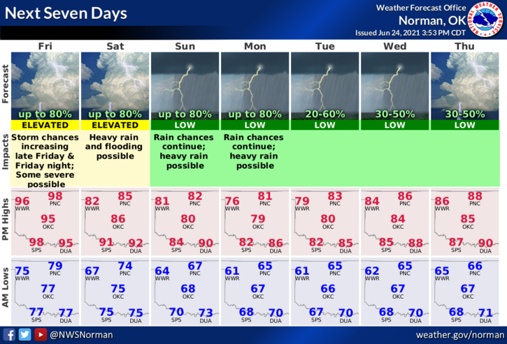
1- We are in a FLOOD WATCH from Friday evening through Sunday afternoon. A weak front will be positioned either over us or just south of our area over the weekend bringing us heavy rain at times. Training storms are possible. Severe storms are also possible with large hail, initially, then a wind threat as the weekend moves forward. This flood watch will be adjusted as this scenario comes together. We could see several inches of rainfall if we end up under the heavier cells.
2- Other than the above, hot, and dry today with strong southerly winds. Heat index temps will be around 100-105. Here is your forecast from the NWS/NORMAN;
Friday-30 percent chance of showers and thunderstorms after 4pm. Mostly sunny and hot, with a high near 100. Heat index values as high as 104. South wind 15 to 21 mph, with gusts as high as 29 mph.
Friday Night-Showers and thunderstorms likely, mainly after 7pm. Cloudy, with a low around 69. South wind 15 to 20 mph becoming south southeast 7 to 12 mph in the evening. Winds could gust as high as 28 mph. Chance of precipitation is 70%. New rainfall amounts between a half and three quarters of an inch possible.
3-Be sure to download our GARFIELD COUNTY EM app. It’s free to you and just might possibly save your life.
HAVE A GOOD DAY!
MIKE