0400-SATURDAY OUTLOOK FROM GARFIELD COUNTY EMERGENCY MANAGEMENT-6/26/21
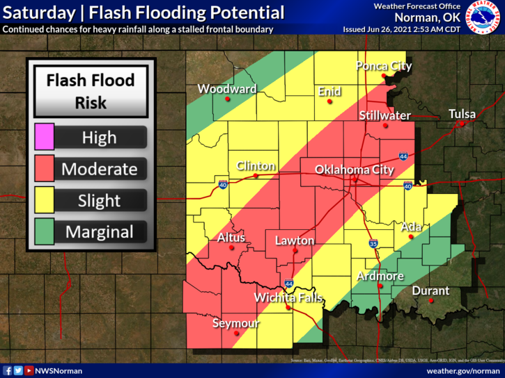
1-FLOOD WATCH UNTIL 6PM SUNDAY EVENING. There are several flash flood warnings in effect around the state right now so if you plan on traveling over the weekend, pay close attention to forecasts in those respective areas.
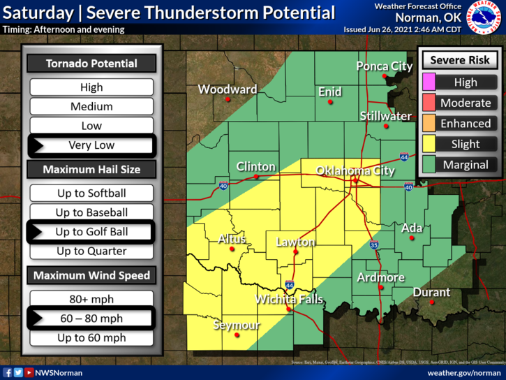
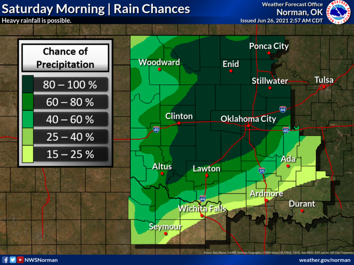
2- The front is stalled just to our south and should remain stationary, per guidance, through the day. This will be the focal point for storms this afternoon. It is hard to determine where exactly this boundary will be this afternoon but refinements to the forecast and storm guidance later this morning and early this afternoon should have a better handle on this. It appears it may end up around the I-44 corridor. We look to be just north of this boundary so expect periods of showers and thunderstorms. Our chances for severe are marginal meaning less likely than points south of us. We’ll see what happens.
3- Concerning fireworks and if you all could copy/paste this to your friends, it would be appreciated. Fireworks stands are in business and folks are buying and heading out into the county to fire them off. Here is the law concerning this-
FIREWORKS- TITLE 68, Article 16-Fireworks, Section 1627- It shall be unlawful to explode or ignite fireworks within five hundred feet of any church, hospital, asylum, unharvested, flammable agricultural crop, public school or where fireworks are stored, sold, or offered for sale. No person shall ignite or discharge any permissible articles of fireworks within or throw the same from a motor vehicle; nor shall any person place or throw any ignited article of fireworks into or at such vehicle or at or near any group of people.
I put this here to help everyone understand that if you start a fire and you’re caught, you could be liable not only for the damage to property but for the response too. That would be expensive. We don’t want this to happen. PLEASE USE GOOD COMMON SENSE.
4-Here is your forecast from the NWS/NORMAN;
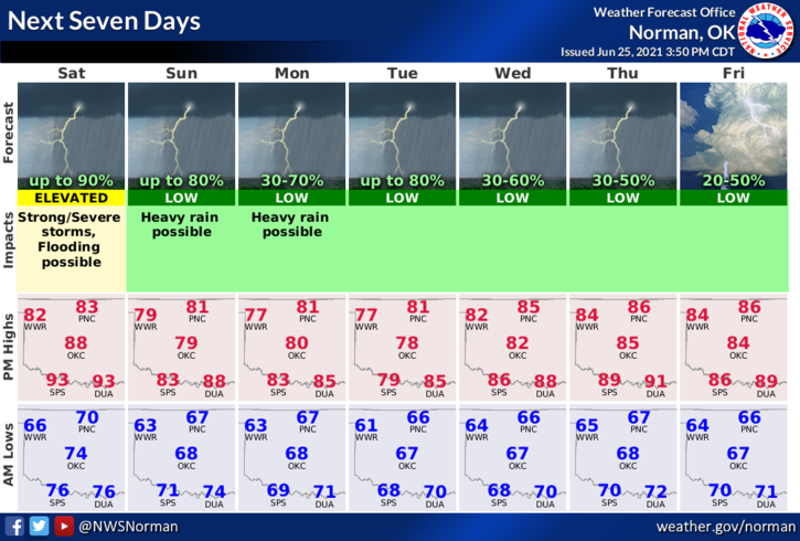
Today-Not as warm. Thunderstorms early in the morning, then thunderstorms likely in the late morning and early afternoon. Thunderstorms late in the afternoon. Highs in the mid-80s. Southwest winds around 10 mph.
Tonight-Mostly cloudy with thunderstorms likely. Lows in the upper 60s. Light and variable winds. Chance of thunderstorms 70 percent.
Download our GARFIELD COUNTY EM app. It just could save your life!
HAVE A GOOD DAY!
MIKE