FROM GARFIELD COUNTY EMERGENCY MANAGEMENT-FRIDAY JUNE 30, 2017
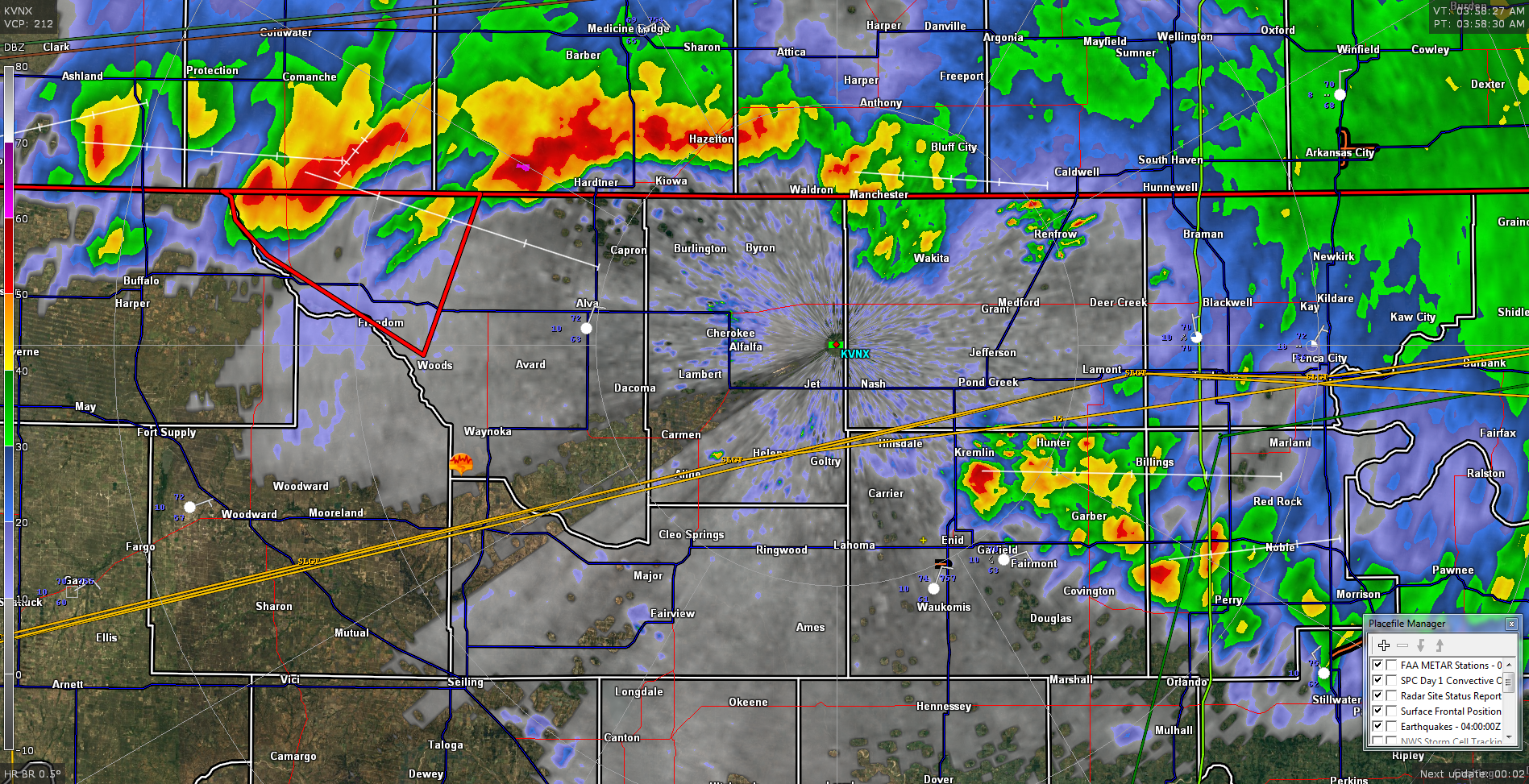
Its 0400L and storms are developing in the county along an outflow boundary moving ESE at 25-30 mph. Other storms along the Oklahoma Kansas border are intensifying. Movement at this time is east at 40 mph. These storms may skirt the area with strong winds, hail, and heavy rainfall. The radar pic attached is from around 4am.
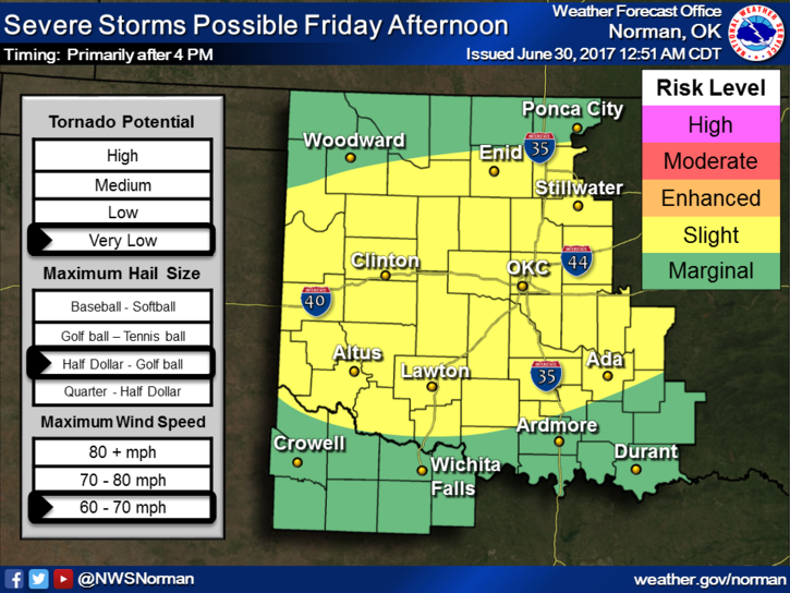
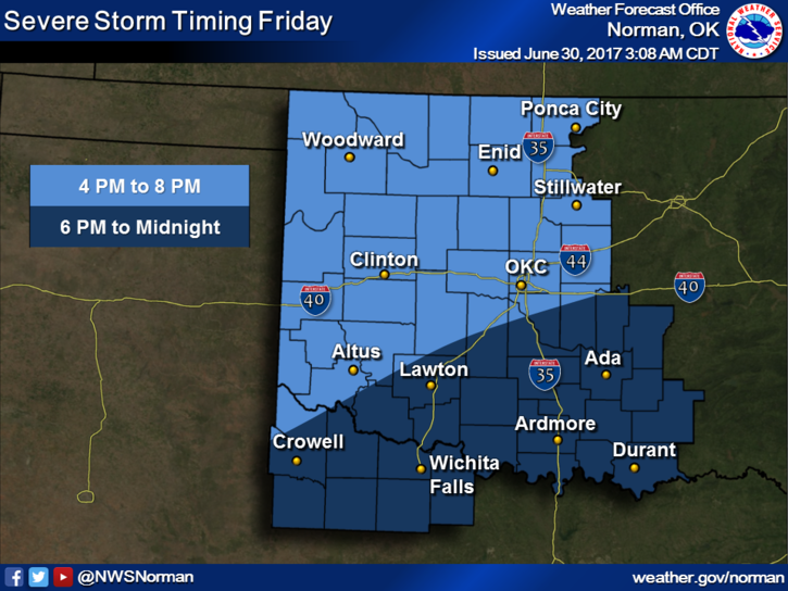
This said, we will see the potential for storms this morning and again possibly later this afternoon into the evening hours. What happens with the storms this morning will possibly affect what happens later this afternoon. Here is your forecast from the NWS/NORMAN;
Friday-40 percent chance of showers and thunderstorms, mainly after 4pm. Partly sunny, with a high near 88. Northeast wind around 7 mph becoming southeast in the morning.
Friday Night-30 percent chance of showers and thunderstorms, mainly before 1am. Mostly cloudy, with a low around 66. North northeast wind 6 to 10 mph.
Overall, we’ll be ok but expect storms possibly off and on from now through the weekend.
I’ll advise as needed. Have a great day!!
MIKE