0425L-FRIDAY UPDATE FROM ENID/GARFIELD COUNTY EMERGENCY MANAGEMENT-6/8/18
1- No “major” risks for thunderstorms today or tonight. We are in a GENERAL risk meaning they could occur anywhere around the area but the main issue will be the HEAT. See the forecast below for percentages.
2- After all the rainfall, I received ¾ of an inch here at home. Kremlin received 3 inches. Drummond received ½ inch. Please send me your rain totals from yesterday to my EMAIL- mike@gcem.org or mhonigsberg@enid.org
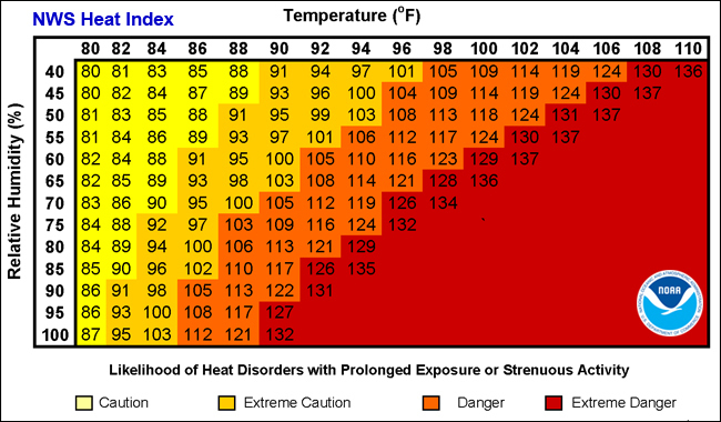
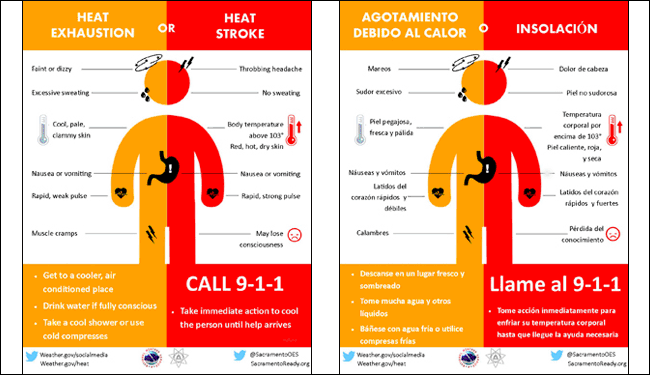
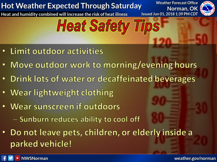
3- Getting back to the heat, humidity will remain high so if you do any yard work outside, pace yourself so you don’t overheat, so to speak. Believe me there is almost nothing worse than physical heat issues due to heat exhaustion or worse. Watch out for ticks and now skeeters, aka mosquitoes.
4- Overall, as we go deeper into the warmer to hot months, pay attention to yourself and what your body is telling you. Once you have had a heat related issue, it will linger for years. JUST PACE YOURSELF.
5- Here is your forecast from the NWS/NORMAN;
Friday-20 percent chance of showers and thunderstorms before 1pm. Cloudy, then gradually becoming mostly sunny, with a high near 91. South wind 9 to 17 mph, with gusts as high as 24 mph.
Friday Night-20 percent chance of showers and thunderstorms before 1am. Partly cloudy, with a low around 72. South southeast wind 10 to 16 mph, with gusts as high as 23 mph.
FINALLY, I need to speak to a person who may be an expert on Facebook and YouTube. We are wanting to do some modifications on our pages and need a little help. Send an email to either address in #2 above and I will contact you early next week. Thank you.
HAVE A GREAT DAY!!
MIKE