0320L-FRIDAY OUTLOOK FROM GARFIELD COUNTY EMERGENCY MANAGEMENT 03/15/24
*The cold front moved through yesterday giving us mostly sunny skies but it gave eastern and southeastern Oklahoma some pretty violent weather. Severe weather is expected again today in far southeastern Oklahoma and there are several shortwave troughs that could affect the southern half of the state today and over the weekend. If you plan on being in the southern or southeastern part of the state this weekend, pay close attention to the weather forecast in that area.
*For our region, mostly sunny skies with gusty north winds today. The Fire Danger is low BUT we ask that you not do any burning while wind gusts are higher than 15 mph. See the forecast below. Also, we’ll have another front push in late Sunday and bring cooler temps back into the area. Just remember that it’s still winter and anything can happen.
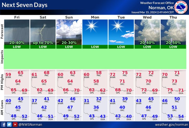
*Overall, we’ll be ok so here is your forecast from the NWS/NORMAN;
Today- Mostly cloudy this morning, then becoming partly sunny. Highs in the mid-60s. Northeast winds 15 to 20 mph with gusts up to 30 mph.
Tonight- Mostly cloudy in the evening, then clearing. Lows around 40. North winds 5 to 10 mph.
HAVE A GOOD DAY!