0325L-THURSDAY OUTLOOK FROM GARFIELD COUNTY EMERGENCY MANAGEMENT 03/14/24
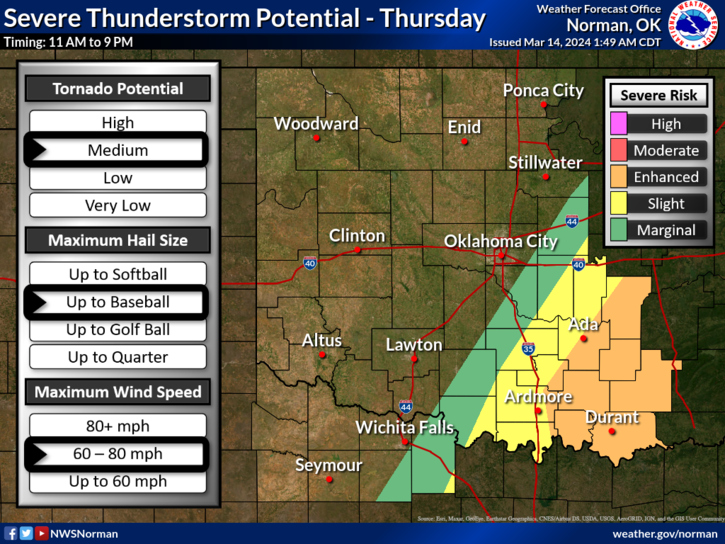
*The Fire Danger is low today but the threat for severe weather is up there in central, southern, and eastern Oklahoma. If you plan on traveling in those directions, all weather hazards are possible from late morning through the afternoon and evening. Large hail and possibly tornadoes appear to be the main threats down that way so use extreme caution if going that way.
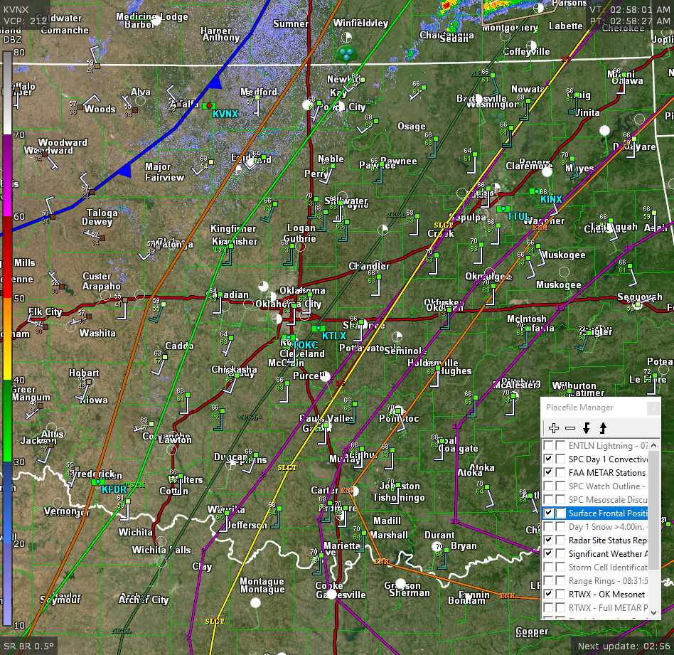
*In looking at the attached radar pic from 0311L you can see a series of colored lines. Starting from the left is a blue line, that’s a front, the brownish line is a trough. The light green line is a General Risk area for severe storms, the darker green line is a Marginal Risk for severe storms, the purple is a 2% risk area for tornadoes, the yellow is a Slight Risk area for severe weather, the next purple line is a 5% tornado risk, the brownish/orange line is an Enhanced risk for severe weather and the last purple line is a 10% risk for tornados. Basically, I would stay away from those areas today.
* For our area, the fire danger is low but still prevalent. Use caution if you decide to do any burning. Call dispatch and report your burn at 580-234-3473. Overall, we’ll be ok so here is your forecast from the NWS/NORMAN;
Today- Mostly sunny. Highs in the lower 70s. Northwest winds 5 to 10 mph.
Tonight- Mostly clear in the evening, then becoming partly cloudy. Lows in the mid-40s. North winds 15 to 20 mph with gusts up to 30 mph.
HAVE A GOOD DAY!