0405L-FRIDAY UPDATE FROM ENID/GARFIELD COUNTY EMERGENCY MANAGEMENT-3/23/18
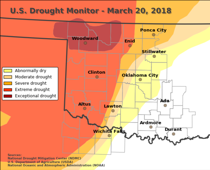
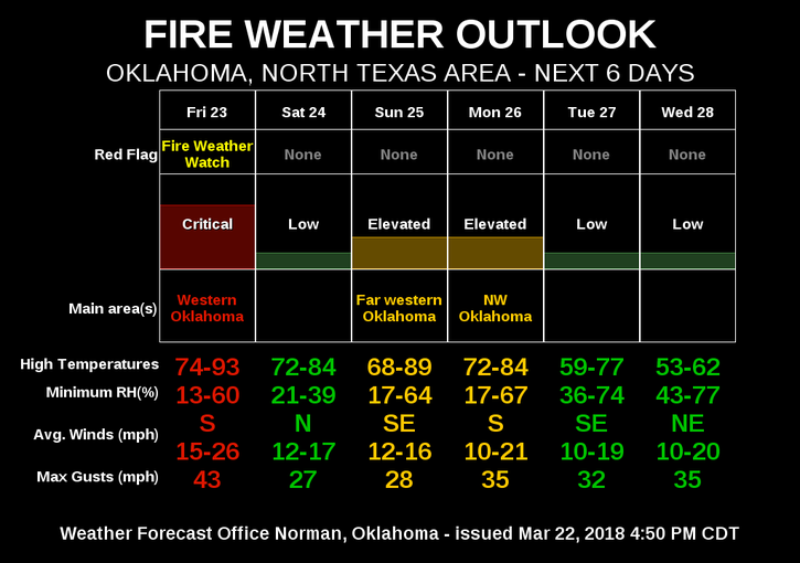
1- RED FLAG FIRE WARNING OUT WEST TODAY. Even though we are not included in that warning, DANGEROUS FIRE WEATHER conditions do exist here too. The main difference is higher humidity. You can see that the rain we had last week didn’t make much difference in the drought monitor graphic. See below. STAY AWARE of the surrounding area and if you see smoke or fire, call 911.
2-WE RECOMMEND–NO CONTROLLED BURNING TODAY EVEN IN A FIRE PIT. We are NOT in a burn ban BUT if you start a fire and it gets out of control and especially if it wonders onto a neighbor’s property, you could be held liable for damage. IT’S BEST NOT TO BURN TODAY.
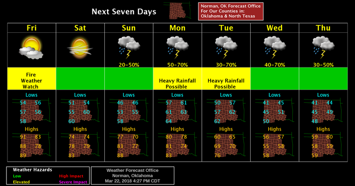
3- Our chance for rain isn’t too good even with boundaries floating around the area as the cap above us should remain very strong. This may change late Sunday so we’ll see how this pans out.
4-Here is your forecast from the NWS/NORMAN;
TODAY-Partly sunny, with a high near 85. Windy. South winds 15 to 20 mph increasing to 25 to 30 mph in the afternoon. Winds could gust as high as 40 mph.
TONIGHT-Mostly clear, with a low around 53. Windy. South winds 20 to 30 mph gusting to 40mph before becoming west northwest 10 to 15 mph after midnight.
5- I will “try” to do a Facebook live video this morning concerning our Fire Weather and possible rain chances as newer data arrives.
HAVE A SUPER DAY AND STAY SAFE!!
MIKE