0355L-FRIDAY OUTLOOK FROM GARFIELD COUNTY EMERGENCY MANAGEMENT 03/08/24
*We missed the storms yesterday but a few areas around the region received some rainfall. We do have a small chance again today so we’ll see what Mother Nature decides to throw at us. The cold front has pushed into the area and it has brought cooler air but the colder intrusion of air will filter in during the day. Highs will only make it into the low 40s and believe it or not, there is an “outside” chance we could see some snow flurries. There is not much of a chance for any major accumulation but we’ll see if it occurs here or not.
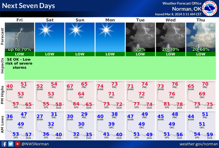
Overall, we’ll be ok but be prepared for a freeze tonight and Sunday morning. Here is your forecast from the NWS/NORMAN;
Today- Cloudy with a chance of thunderstorms. A chance of showers. Much cooler with highs in the upper 40s. North winds 15 to 20 mph with gusts up to 30 mph. Chance of rain 40 percent.
Tonight- Mostly cloudy. A slight chance of rain showers in the evening. Colder with lows around 30. North winds 15 to 20 mph with gusts up to 30 mph. Chance of rain 20 percent.
HAVE A GOOD DAY!