0412L-FRIDAY OUTLOOK FROM ENID GARFIELD COUNTY EMERGENCY MANAGEMENT-11/30/18
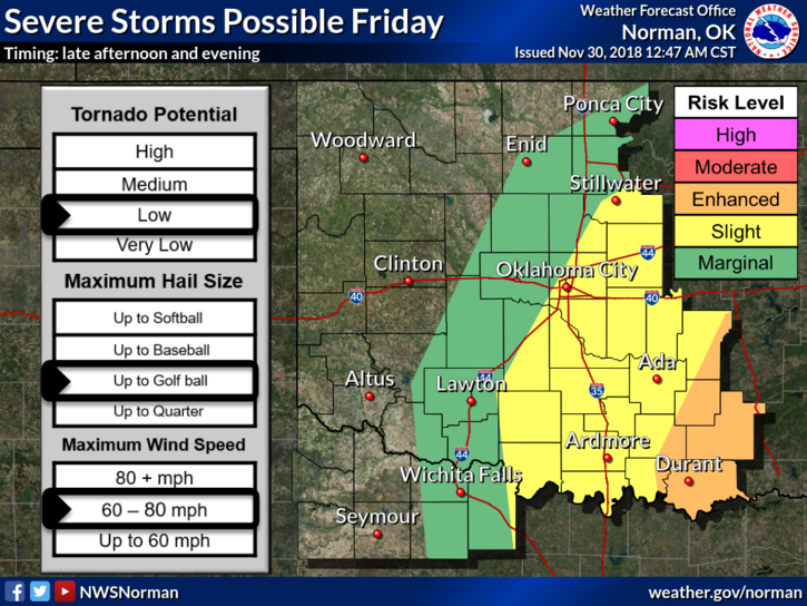
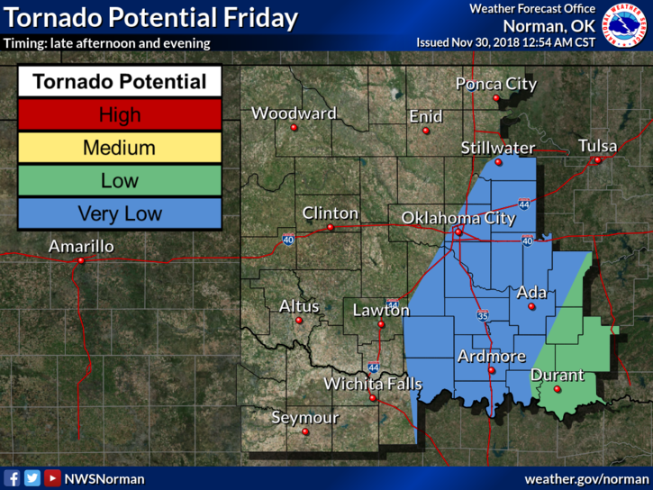
1-We are in a MARGINAL RISK area for severe weather later today. An Enhanced Risk is located in Southeast Oklahoma. We are also in a DENSE FOG ADVISORY this morning until 10am. Our chances for severe weather here are low but not completely out of the question. Now is a good time to download our GARFIELD COUNTY EM app. Stay prepared with it.
2-IF you plan on traveling south or southeast later today, stay up with the latest weather info from the NWS/NORMAN: https://www.weather.gov/oun/ If you plan on attending the OU game, keep up with conditions with the NWS FORT WORTH/DALLAS, https://www.weather.gov/fwd/ These links are also on our gcem.org website.
3- Here is your forecast from the NWS/NORMAN;
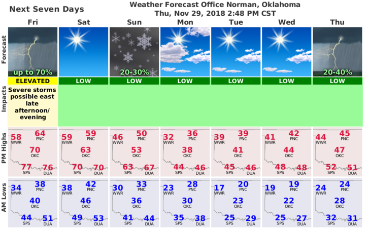
Today-Mostly cloudy. Areas of dense fog in the morning. A slight chance of rain showers early in the afternoon. A chance of thunderstorms late in the afternoon. Some thunderstorms may be severe. Highs around 60. East winds around 10 mph. Chance of precipitation 30 percent.
Tonight-Partly cloudy. A chance of thunderstorms in the evening, then a slight chance of rain showers after midnight. Lows around 40. Southeast winds around 10 mph shifting to the southwest after midnight. Chance of precipitation 50 percent.
Finally, I’ll advise as needed throughout the day on storm potential.
Have a super day!!
MIKE