0402L-FRIDAY UPDATE FROM ENID/GARFIELD COUNTY EMERGENCY MANAGEMENT-11/9/18
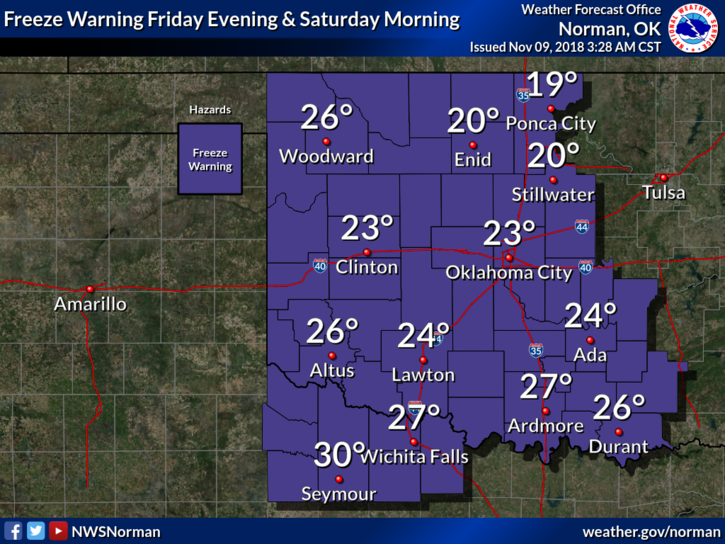
1- “FREEZE WARNING” STILL IN EFFECT UNTIL 9 AM THIS MORNING. THE FREEZE WARNING FOR FRIDAY NIGHT IS STILL IN EFFECT FROM 9 PM TONIGHT UNTIL 10 AM SATURDAY MORNING.
2-Here is your forecast from the NWS/NORMAN;
Friday: Partly cloudy, then gradually becoming sunny with a high near 43. Northwest wind 5 to 15 mph gusting to 25 mph.
Friday Night-Clear, with a low around 20. North wind 5 to 9 mph becoming light and variable.
3- It will be chilly today and the wind chill will make it seem colder. Wear a coat and “pants”. On the lighter side of this comment, don’t walk up to me wearing a coat and shorts and tell me you’re cold. Those who know me will understand my comment back to them.
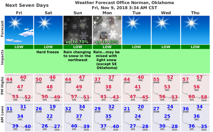
4- Finally, we are expecting to see some snowfall late Sunday into the overnight hours into Monday. Some of you may want to review driving habits on slick surfaces. There is no way to predict snowfall totals since the storm track isn’t set in stone yet. Many variables out there. It will be cool to see the snow since we haven’t had much in recent years.
5- Get our GARFIELD COUNTY EM app. We’ll send advisories as needed.
HAVE A SUPER DAY!!
MIKE