0410L-FRIDAY OUTLOOK AND INFO FROM GARFIELD COUNTY EMERGENCY MANAGEMENT-10/11/19
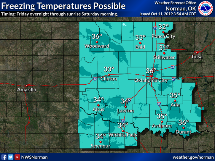
FREEZE WATCH IN EFFECT FROM LATE FRIDAY EVENING UNTIL 0900 SATURDAY MORNING.
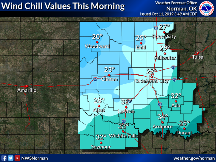
1- Monitoring stations in the county are mostly in the upper 30’s as of 0345L this morning. Winds are out of the north on average at 20 mph. The WIND CHILL is around 30 and temps will drop some more by daybreak. Since this is the first colder morning of this fall, protect yourself by wearing the proper clothing while outdoors. Colder temps can have various effects on you especially when you’re not use to it. Yes, IT FEELS GOOD, JUST BE CAREFUL.
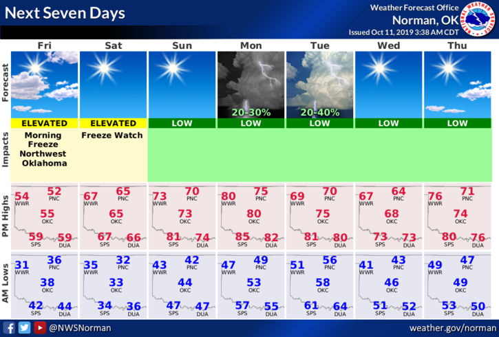
2- Overall, mostly sunny skies, cooler temps, a lot less humidity, and or normal windy conditions will be the norm over the weekend. Get out and enjoy it.
3- Here is your countywide forecast from the NWS/NORMAN;
Today- Partly cloudy early in the morning then clearing. Cooler with highs in the mid-50s. Northwest winds 10 to 20 mph.
Tonight- Clear with lows in the lower 30s. West winds, up to 10 mph in the evening becoming light and variable.
Download our GARFIELD COUNTY EM app, learn how it works and read the information within it. That alone can help you be prepared especially this winter.
HAVE A GREAT DAY!!
MIKE