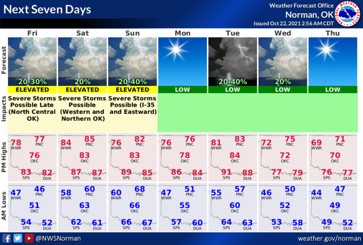
0320L-FRIDAY OUTLOOK FROM GARFIELD COUNTY EMERGENCY MANAGEMENT-10/22/21
1- We are in a GENERAL RISK AREA for thunderstorms but near a MARGINAL RISK area to our northeast today and tonight during the overnight hours. Without re-writing the SPC discussion, IF storms occur, they would be high based thus more of a hail/wind threat so we’ll see how this comes together. I think most of the energy will be east and northeast of us but we’ll watch and see.
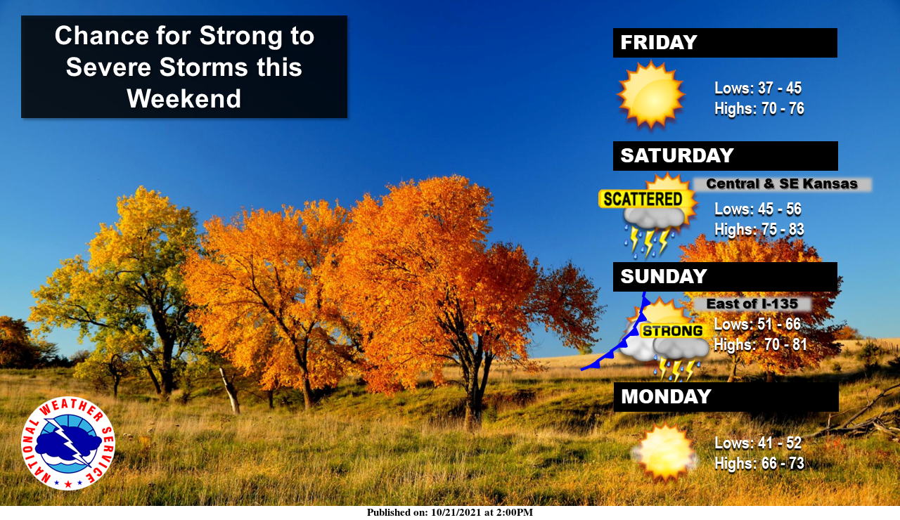
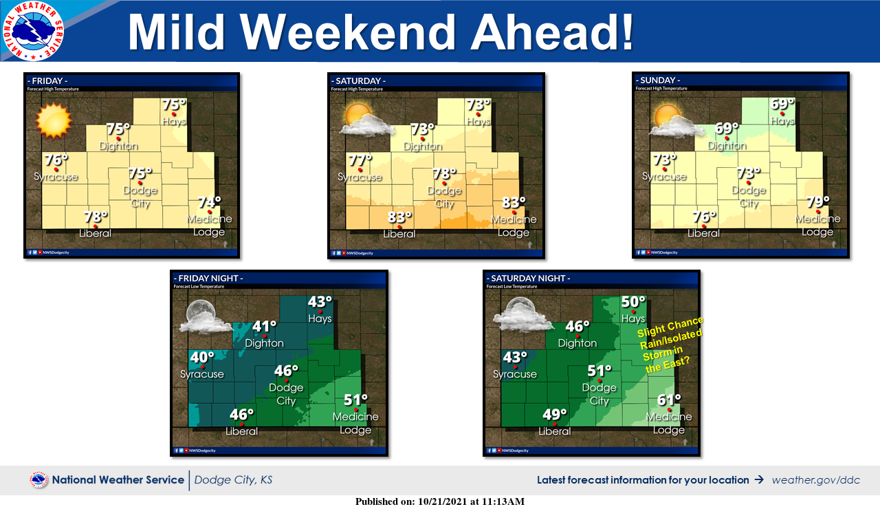
2- We’ll see warmer temps and chances for rain over the weekend. We do expect a few fronts through the area late this weekend and early next week. Again, we’ll see what happens. Here is your forecast from the NWS/NORMAN;
Today-Sunny early, then becoming partly cloudy late morning/early afternoon then becoming sunny. A slight chance of thunderstorms late in the morning. Highs in the upper 70s. South winds 10 to 15 mph. Chance of thunderstorms 20 percent.
Tonight-Mostly clear then a slight chance of thunderstorms after midnight. Warmer. Lows in the upper 50s. South winds around 10 mph. Chance of thunderstorms 20 percent.
FINALLY, we have a new survey for our HAZARD MITIGATION PLAN that I need your input on. When you have time, go to this link, and do both surveys if possible but for sure the lower one. Here is a hyper-link to our website- https://gcem.org/ The survey is in the light red box. Thank you for helping us out.
HAVE A SUPER DAY!
MIKE