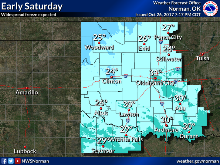
FROM GARFIELD COUNTY EMERGENCY MANAGEMENT-FRIDAY-10/27/17
FREEZE WARNING IN EFFECT FROM MIDNIGHT TONIGHT UNTIL 10 AM CDT SATURDAY.
THE WIND ADVISORY IS STILL IN EFFECT UNTIL 7AM THIS MORNING.
A FREEZE WARNING MEANS SUB-FREEZING TEMPS ARE IMMINENT OR HIGHLY LIKELY. THESE CONDITIONS WILL KILL SENSITIVE CROPS AND VEGETATION.
As stated in earlier posts before, make sure you take the proper precautions to protect yourself, your family, your house, your vehicles, and your pets from these colder temps starting tonight. As I type this morning AT 0355L, its 41 degrees with north winds at 28 mph gusting to 35mph. This gives a wind chill of roughly 31 degrees. Wind chill temps can injure skin so be careful. That said, here is your forecast from the NWS/NORMAN;
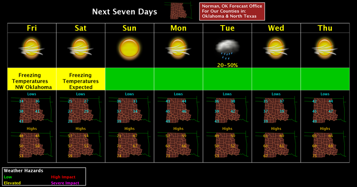
Friday-Areas of blowing dust before 7am. Partly sunny, then gradually becoming sunny, with a high near 48. North northwest wind 15 to 20 mph, with gusts as high as 30 mph.
Friday Night-Clear, with a low around 24. Northwest wind 5 to 10 mph.
STAY SAFE and have a GREAT DAY!!
MIKE