FROM GARFIELD COUNTY EMERGENCY MANAGEMENT-FRIDAY-9/15/17
Download our emergency app-GARFIELD COUNTY EM– it just might SAVE YOUR LIFE!!
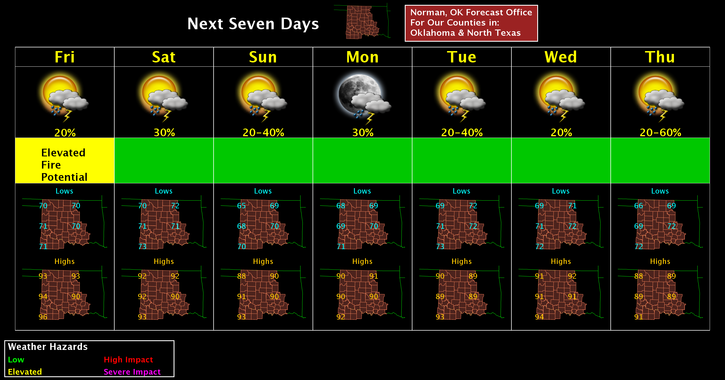
It’s Friday once again and we have made it to the middle of September. Highs appear to remain around 90 and lows around 70 for the next week or so. This will fluctuate some but overall not too bad. Get out and enjoy before the cold weather arrives. If we’re lucky, the cold will arrive by Christmas!! That said, here is your forecast from the NWS/NORMAN;
Friday-Mostly sunny, with a high near 95. Heat index values as high as 98. South wind 13 to 21 mph, with gusts as high as 29 mph.
Friday Night-20 percent chance of showers and thunderstorms after 1am. Mostly cloudy, with a low around 72. South wind 14 to 17 mph, with gusts as high as 24 mph.
FINALLY, in the preparedness area- as stated in earlier posts, the FIRE DANGER IS HERE. We are dry, humidity is dropping, and winds are increasing. The one important number to know is 911. If you see smoke or even fire, call 911 and report it. It may be a controlled burn that we are aware of but if it’s not, property can be saved by your awareness.
Have a great day!!
MIKE