FROM GARFIELD COUNTY EMERGENCY MANAGEMENT-SATURDAY-9/16/17
DOWNLOAD OUR EMERGENCY APP-GARFIELD COUNTY EM-IT JUST MIGHT SAVE YOUR LIFE!
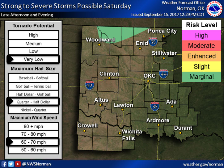
ADVISORY: We are just south of a MARGINAL RISK for severe weather later today and tonight, if you go by lines on a map. We are close enough to realize that we could be included later today. Either way, keep an eye out later this afternoon and tonight as all of this develops. If storms occur, expect gusty winds, hail, and heavy rainfall.
Overall, we’ll be ok. Keep an umbrella in the truck or car just in case. Here is your forecast from the NWS/NORMAN;
Saturday-40 percent chance of showers and thunderstorms mainly after 1pm. Partly sunny with a high near 94. Heat index values as high as 97. South winds 15 to 20 mph, with gusts to 25 mph.
Saturday Night-40 percent chance of showers and thunderstorms. Mostly cloudy with a low around 69. South winds 5 to 15 mph gusting to 20 mph.
Come see us at the Cherokee Strip Parade this morning.
HAVE A SUPER DAY!!
MIKE