0340L-FRIDAY OUTLOOK FROM GARFIELD COUNTY EMERGENCY MANAGEMENT-9/24/21
1- Conditions today will be similar to yesterday with warm temps, low humidity, and strong winds. We will have a cold front move through the area later this afternoon per guidance, but temps really won’t be affected much. A wind shift is about all we’ll feel. No precipitation is expected.
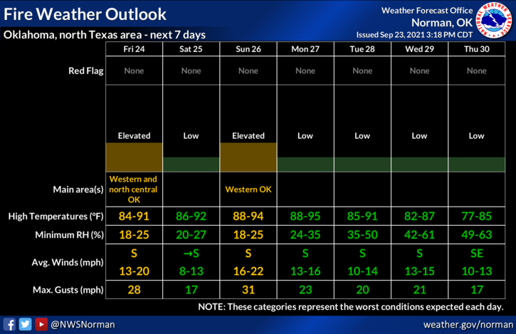
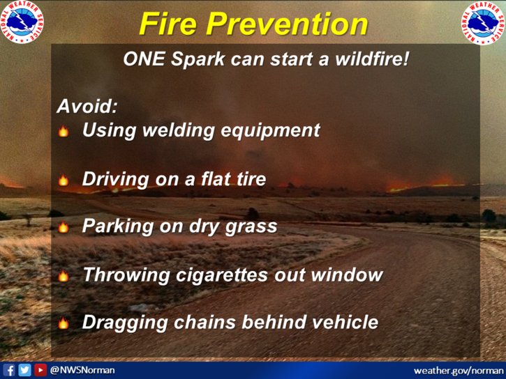
2- FIRE WEATHER conditions are still in effect again today and will remain in some way, shape, or form for the foreseeable future. Use EXTREME CAUTION if you utilize anything related to fire. The fire danger statement is below the forecast. Overall, we’ll be ok so just be careful out there. Here is your forecast from the NWS/NORMAN;
Friday-Partly sunny, with a high near 89. South southwest wind 10 to 20 mph, with gusts as high as 25 mph.
Friday Night-Mostly clear, with a low around 55. South wind 5 to 10 mph becoming northeast after midnight.
FIRE DANGER STATEMENT
NATIONAL WEATHER SERVICE NORMAN OK
148 AM CDT FRI SEP 24 2021
OKZ004>007-009>012-014>017-021-022-033>037-TXZ083>085-242300-
HARPER-WOODS-ALFALFA-GRANT-ELLIS-WOODWARD-MAJOR-GARFIELD-
ROGER MILLS-DEWEY-CUSTER-BLAINE-BECKHAM-WASHITA-HARMON-GREER-
KIOWA-JACKSON-TILLMAN-HARDEMAN-FOARD-WILBARGER-
148 AM CDT FRI SEP 24 2021
…ELEVATED FIRE WEATHER CONDITIONS EXPECTED…
* AFFECTED AREA…WESTERN OKLAHOMA AND PARTS OF NORTHERN OKLAHOMA AND WESTERN NORTH TEXAS.
* WINDS…SOUTHERLY WINDS AT 10 TO 15 MPH WITH GUSTS OF 20 TO 25 MPH. A NORTHERLY WIND SHIFT WILL MOVE INTO FAR NORTHERN OKLAHOMA
BY LATE AFTERNOON.
* RELATIVE HUMIDITY…MINIMUM RELATIVE HUMIDITY NEAR 20%.
* TEMPERATURES…HIGHS TEMPERATURES FROM 85 TO 92 DEGREES.
* TIMING…1 PM TO 6 PM.
OUTDOOR BURNING AND ACTIVITIES THAT CAUSE OPEN SPARKS OR FLAMES ARE DISCOURAGED. FIRE AND EMERGENCY OFFICIALS SHOULD BE AWARE THAT
WEATHER CONDITIONS WILL BE FAVORABLE FOR THE DEVELOPMENT OF GRASS FIRES.
STAY SAFE,
MIKE