0310L-FRIDAY OUTLOOK FROM GARFIELD COUNTY EMERGENCY MANAGEMENT-9/29/23
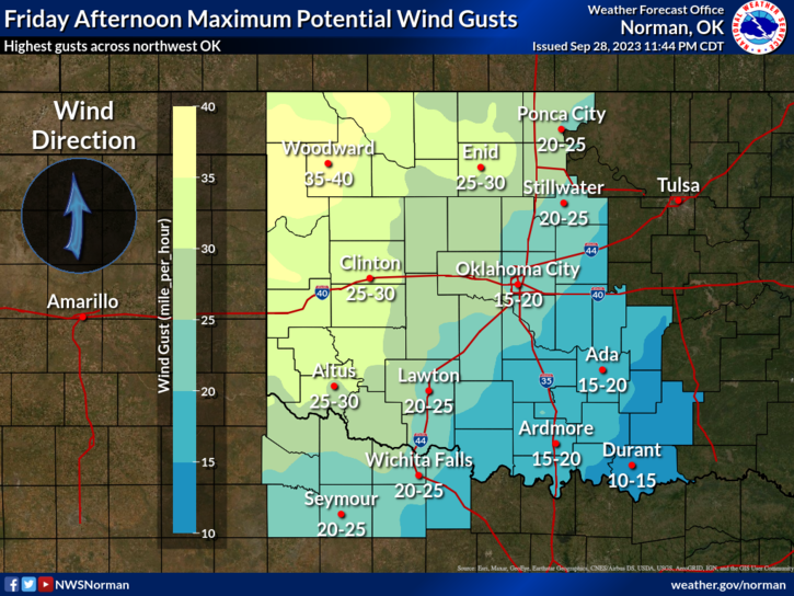
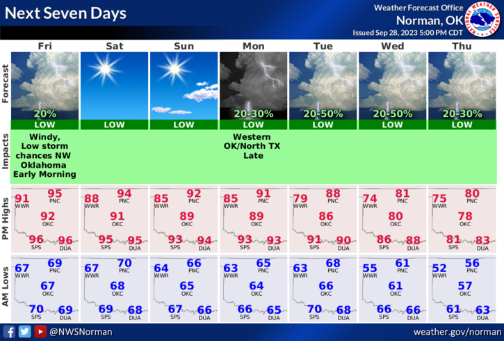
*Continued warm/hot through the weekend. We are adding wind to this mess right now and we will see wind gusts upwards of 25-30 mph at times during the day. Winds over the weekend appear to lessen some but they will still be around. This will increase the fire danger a little but dewpoint temps are expected to stay in the low 60s and relative humidity should stay in the low to mid 30s. Stay fire aware and if you see smoke or fire, call 9-1-1 so a quick response can be sent.
*Next week, we’ll have a cold front coming through giving us a chance for rain. Models are not all in agreement on this but as we get closer the data should hopefully come together. We could see high temps by NEXT weekend in the 70s. We’ll see how this comes together. For this weekend, enjoy the warmth and windy conditions. Continue to get ready for the winter. It will be here before you know it.
Overall, we’ll be ok so here is your forecast from the NWS/NORMAN;
Friday- Sunny, breezy with highs in the lower 90s. South winds 10 to 15 mph, increasing to 15 to 25 mph in the afternoon with higher gusts.
Friday Night- Mostly clear. Lows in the upper 60s. South winds 15 to 20 mph.
* The WSR-88D weather radar at Kegelman Field known as KVNX is still down. Return to service is still undetermined. Hopefully it will be repaired soon.
HAVE A GOOD DAY!