0330L-SATURDAY OUTLOOK FROM GARFIELD COUNTY EMERGENCY MANAGEMENT-9/30/23
* The WSR-88D weather radar at Kegelman Field known as KVNX has returned to service.
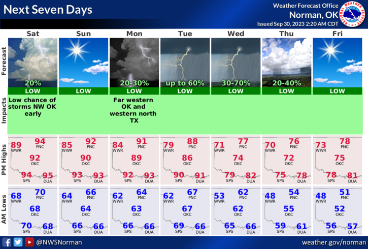
*Above average temps will continue through the weekend with a slight chance for showers out west. For our area, just warm and windy at times. This said, a slow downward trend in temps will occur starting Monday with highs in the mid-80s and ending up in the low 70s by Friday. Rain comes back into the picture here by Tuesday morning or so and then a cold front pushes into the area Wednesday. There is hope for cooler temps and it is on its way.
* Overall, we’ll be ok so hang in there on the temperature thing and hopefully this week we’ll see the hotter temps go away for a while. Here is your forecast from the NWS/NORMAN;
Today- Sunny. Highs in the lower 90s. South winds 10 to 15 mph with gusts up to 25 mph.
Tonight- Mostly clear. Lows in the mid-60s. Southeast winds 10 to 15 mph.
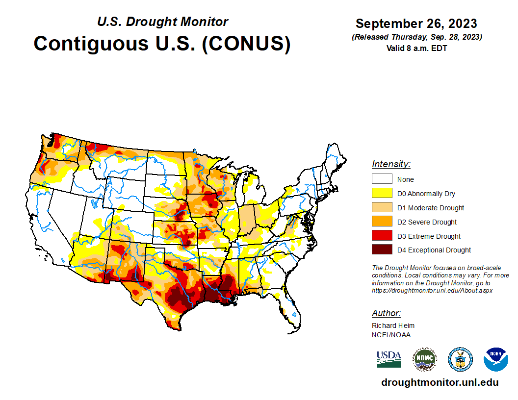
*Finally, until we see additional rainfall, the Fire Danger will remain across the area. We range from Abnormally dry to Severe on the Drought Monitor so be careful. The fire danger isn’t high per say but use caution when utilizing anything related to fire out there. If you make a mistake, call 9-1-1.
Have a good day!